Wave indication, Weather icons, Marine zones – B&G Zeus2 Glass Helm CPU User Manual
Page 97: Tropical statements, Adjusting color codes
Wave indication
Colors are used to indicate forecasted wave height. The highest waves are dark red, while the
lowest are blue.
You can define how the color codes are used to identify the wave height. See "Sirius Weather -
Color Shading" on page 97.
Weather icons
Several weather icons are available to show current or predicted weather conditions. You can
select an icon to display detailed weather information.
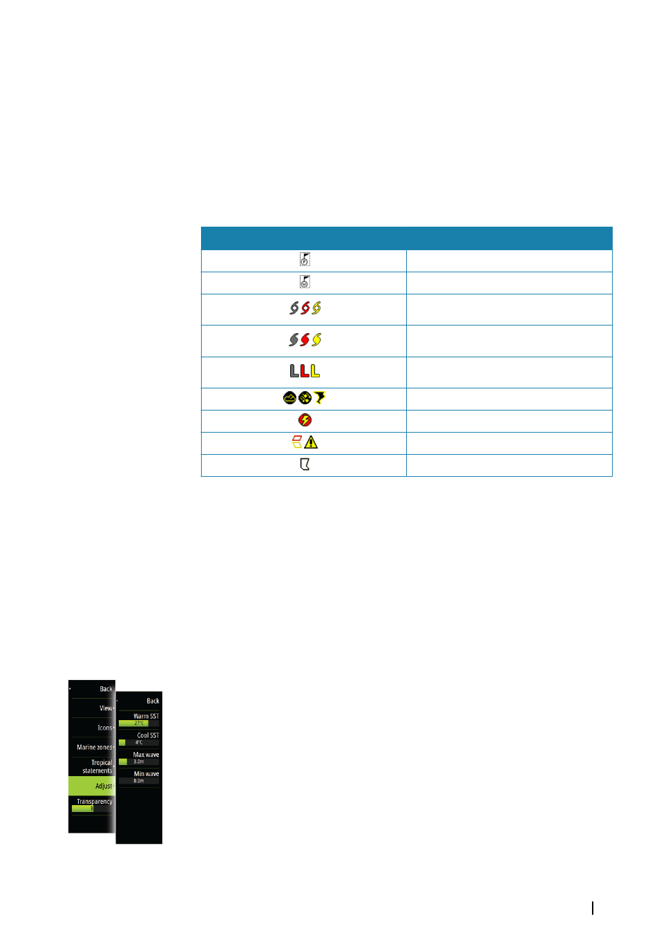
Icon
Description
City forecast
Surface observation
Tropical storm tracking; past (grey) - present
(red) - future (yellow)
Hurricane (category 1-5) tracking; past (grey)
- present (red) - future (yellow)
Tropical disturbance/depression tracking;
past (grey) - present (red) - future (yellow)
Storm attributes
Lightning
Watch box location and warning
Marine zone location
Marine zones
Sirius™ service includes access to weather reports for all U.S. Marine Zones, with the
exception of the high seas zones.
You can setup the system to read the forecast for a selected area.
Select the selected zone, and use the menu to confirm your selection.
Tropical statements
You can read tropical statements including information about tropical weather conditions.
These statements are available for the entire Atlantic and the Eastern Pacific.
Adjusting color codes
You can define the sea surface temperature range and wave height color coding.
The temperature above warm and below cool values will be displayed as progressively
darker red and darker blue.
Waves higher than the maximum value will be indicated with progressively darker red.
Waves lower than the minimum value will not be color coded.
Weather
| Zeus
2
Glass Helm
97