Triton SB-Interpreter User Manual
Page 14
Page 11
BACKGROUND IMAGE ADJUSTMENTS
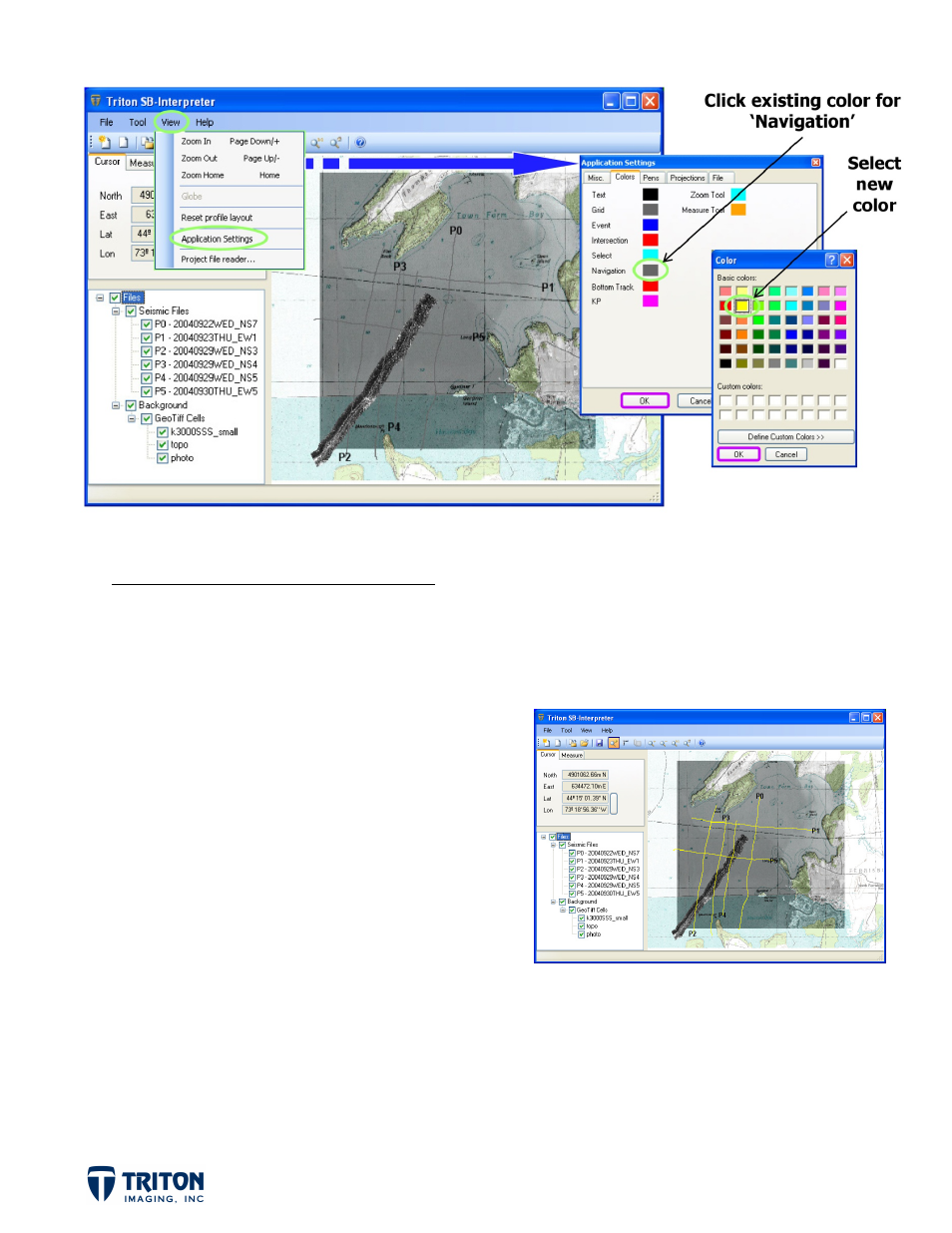
With the aerial photo showing through the chart, the default color for the sub-bottom profile
navigation lines is too dark. Color options for survey navigation are located in the ‘Application
Settings’.
STEP 3B: Image Adjustments (cont.)
d.
Select the ‘Colors’ tab in ‘Application
Settings’ in the ‘View’ menu
e.
Click on the current color for
‘Navigation’
f.
Select ‘Yellow’ as the new color
Adjusting the background imagery and default color settings in the map view assists with
interpretation by allowing cross-referencing between data types (multibeam, sidescan, and
sub-bottom) and regional features shown in topo maps, navigation charts and aerial
photographs.