Using sextant readings to calculate location – DAVIS Mark 15, 25 Sextant User Manual
Page 12
Page 10
USING SEXTANT READINGS
TO CALCULATE LOCATION
Before attempting to calculate your location using readings from your sextant, you
need to be familiar with the following concepts:
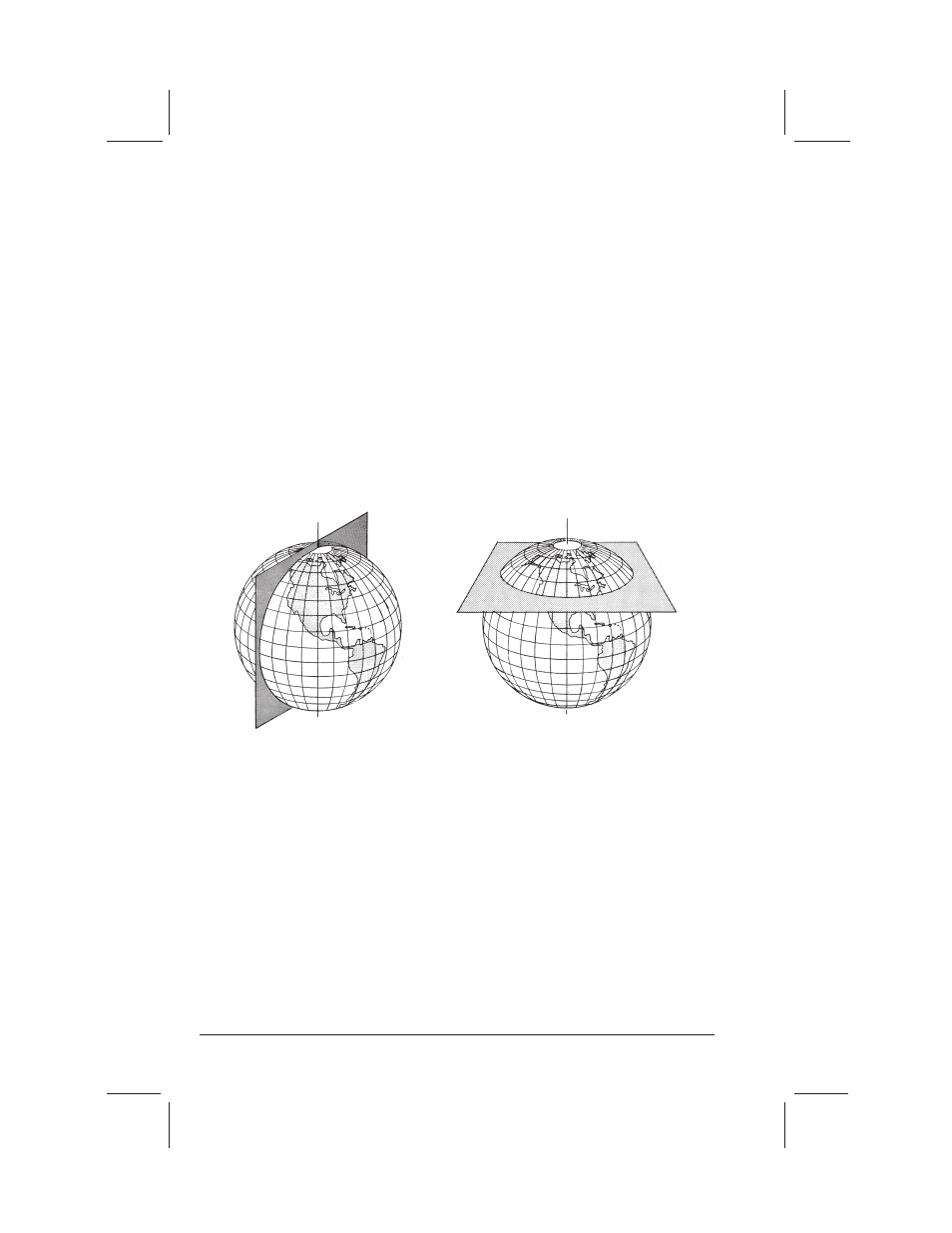
■ A GREAT CIRCLE is a circle on the surface of the earth, the plane of
which passes through the center of the earth.
The equator and the meridians (perpendicular to the equator) are great cir-
cles. See Fig. 12.
■ A SMALL CIRCLE is one whose plane does NOT pass through the center
of the earth.
Parallels of latitude are small circles which become progressively smaller as
the distance from the equator increases. At the poles (90° N or 90° S), they
are single points.
■ A NAUTICAL MILE is equal to one minute of arc of a great circle.
Latitude is measured north or south from the equator along a meridian (a
great circle). One minute of latitude equals one nautical mile anywhere on the
earth. Longitude is measured east or west from the prime meridian (zero
degrees) at Greenwich, England. It is measured along a parallel of latitude (a
small circle). One minute of longitude equals one nautical mile only at the
equator. Approaching the poles, one minute of longitude equals less and less
of a nautical mile (Fig. 13).
Note: The nautical mile (6076 feet; 1852 meters) is longer than the statute
mile used on land (5280 feet; 1609 meters). The earth measures 21,600 nauti-
cal miles in circumference.
Figure 12
A great circle.
A small circle.