15 on-screen navigation icons – Telenav Scout v1.2 for Windows for T-Mobile User Manual
Page 35
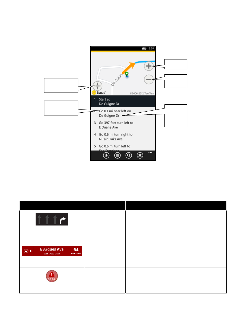
The Follow Me Map is available when you choose Directions on the Route Planning screen. This is useful if you need
to access step-by-step driving directions in an area with weak GPS. You can scroll through the turn-by-turn directions
and choose a segment to view turn details on the map. The content on the Follow Me map is explained below.
Zoom In
Zoom
Out
Center map on
current location
11.15 On-Screen Navigation Icons
The following table explains some of the icons that you may see during a navigation session when viewing a 2D or 3D
Map.
Icon
Name
Function
The Lane Assist feature is designed to help you
determine which lane(s) to be in at a multi-lane highway
junction or an intersection. As you approach a turn or
junction, the Lane Assist graphic will be displayed on the
screen with correct lanes highlighted for your route. Lane
Assist is shown at the bottom of the screen.
Lane Assist
Speed Limit
The legal speed limit will be displayed on the screen for
major roads and highways. The bottom toolbar will turn
red with an “Over Speed Limit” warning if you are
exceeding the posted limit.
When you are viewing moving maps during navigation
and have set Traffic Incident Alerts to “On” in Extras >>
Settings >> Traffic Incident Alert, an icon will appear on
the map if there is an accident less than 15 miles ahead
of your current route. You will see the distance along the
Traffic Incident Alert
Next turn
and
street
name
Distance until
next turn
© 2013 Telenav, Inc.
Page 35 of 70