NISSAN 2008 NAVIGATION SYSTEM User Manual
Page 58
Black plate (60,1)
Model "NAV2-N" EDITED: 2007/ 3/ 9
Road color
The road types are differentiated by colors.
Freeway: Pink with red border
Main road: Amber
Narrow street: Gray
Road with incomplete map data: Dark green
Traffic information on map
With a subscription to XM
®
NavTraffic
TM
service,
traffic information is displayed.
“VIEWING AVAILABLE TRAFFIC IN-
FORMATION” (page 7-3)
Free Flow: Green arrow
Moderate traffic: Yellow arrow
Heavy traffic: Red arrow
Section affected by serious traffic event: Purple
dashed arrow
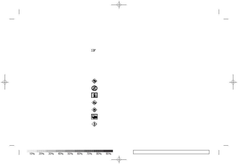
Traffic information icons:
Accident
Closed road
Information
Road work
Slippery road
Weather
Incident
3-24
Map settings