Using the plot screen – Magellan GPS 320 User Manual
Page 21
Magellan GPS 315/GPS 320
13
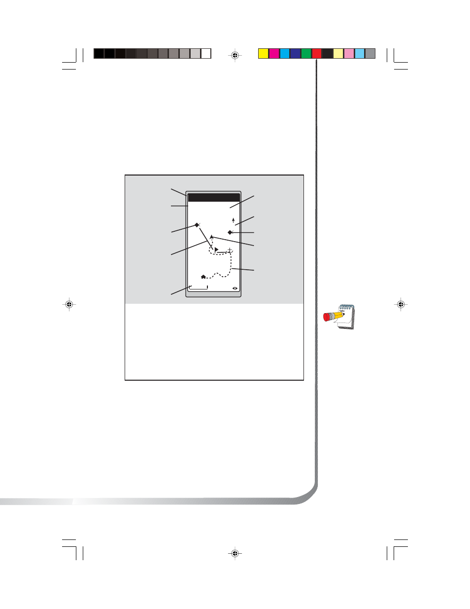
Using the Plot Screen
The PLOT screen is a mini map that shows where you have
traveled and where you want to travel. You can view the
active route, your current position and the other waypoints
and destination in the PLOT screen.
TO: FISH
BRG
351
m
DST
3.52
m
I
2.0
m
I
N
HOME
FISH 2
FISH
DOCK
BUOY
°
Distance to
Destination
North Indicator
Waypoint Icon
Current Position
Icon
Track History
Plot Scale
Active Route
Destination Icon
Bearing to
Destination
Destination
Name
Active Route
Indicates the direction
required to reach your
destination.
Plot Scale
Can be
changed by using the
left/right arrows. The
scale ranges from .1 to
200 miles.
PAN-N-SCAN, an
additional feature,
allows you to scroll
through the PLOT
screen enabling you
to create waypoints
and GOTOs.
Track History
Automatically records
where you have been.
- GPS 315 (5 pages)
- Maestro 3200 (60 pages)
- CrossoverGPS 980890-05 (80 pages)
- Maestro 4040 (75 pages)
- RoadMate 1212 (60 pages)
- ROADMATE 5045 (42 pages)
- RoadMate 1470 (44 pages)
- 330 Series (94 pages)
- RoadMate 1400 (60 pages)
- MAESTRO 3210 (68 pages)
- Maestro 4000 (71 pages)
- Maestro 4000 (75 pages)
- RoadMate 1700 (40 pages)
- Meridian (102 pages)
- Maestro 3225 (60 pages)
- Maestro 4370 (9 pages)
- eXplorist 400 (119 pages)
- TRITON 200 (31 pages)
- Triton 400 (61 pages)
- Triton 300 (30 pages)
- Triton 500 (30 pages)
- RoadMate 2035 (41 pages)
- MAESTRO 3100 (55 pages)
- RoadMate 700 (68 pages)
- RoadMate 700 (27 pages)
- ROADMATE 5045T (42 pages)
- Maestro 3220 (60 pages)
- NAV 6510 (114 pages)
- Maestro 4050 (86 pages)
- RoadMate 1210 1200 Series (48 pages)
- Triton 1500 (63 pages)
- RoadMate 2036 (42 pages)
- MAP410 (8 pages)
- RoadMate 1440 (48 pages)
- RoadMate 1230 (68 pages)
- GPS 310 (62 pages)
- RoadMate 1340 (44 pages)
- 3140 (67 pages)
- Triton 300 (30 pages)
- 750M (30 pages)
- 500 (119 pages)
- ROADMATE 860T (106 pages)
- eXplorist 100 (77 pages)
- Meridian FAQ (30 pages)
- 4010 (76 pages)