30 outputting cursor position to navigator, 32 visual alarm indications, St–by – Furuno 851 MARK-2 User Manual
Page 30
2-21
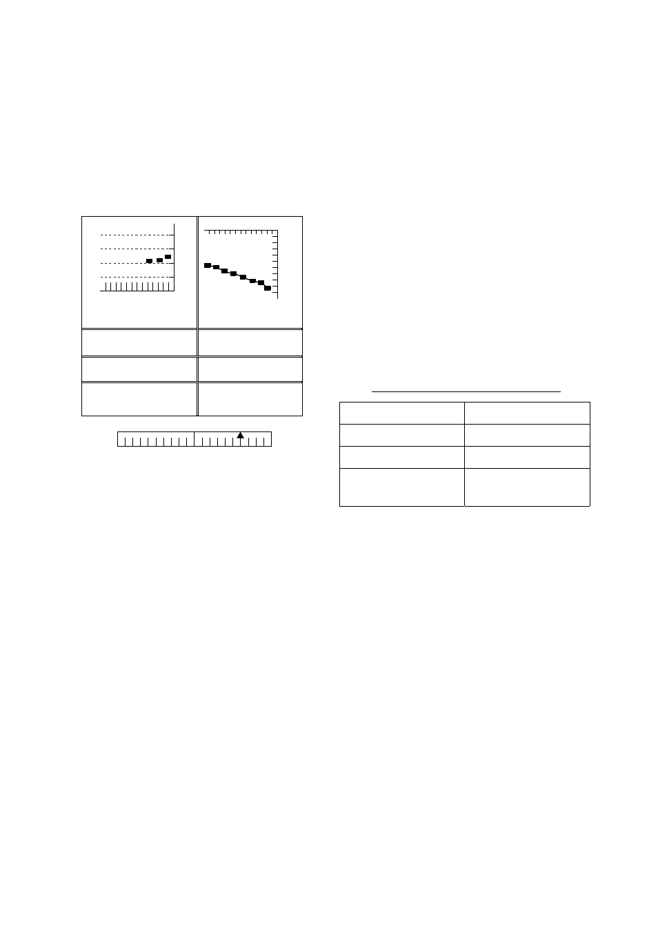
Note 1: The depth display scale changes
automatically with depth and the
maximum depth is 1,000 meters.
Note 2: The barometer display is updated
hourly, thus the data shown may
not be the latest.
DATE TIME TEMP CRS
08.22 15:19 30.0
˚C
0.0˚M
DEPTH XTE SPD
827 m 0.6NM R 30.0KT
WAYPOINT POSI L/L
65˚43.98N
165˚43.96E
XTE
1
1
0
0.5
0.5
XTE
(NM)
L
R
BAROMETER
DEPTH
0
500
1000
(m)
1
2
(MIN)
-12
-9
-6
-3
1020
1010
1000
990
(HOUR)
(mbar/hPa)
ST–BY
12.0NM 114.8˚R
Figure 2-23 Navigation data display during
stand-by
2.30 Outputting Cursor
Position to Navigator
Cursor position (NMEA0183 data sentence
TLL) can be output to the navigator
connected to this radar by pressing and
holding down the [HM OFF] key.
2.31 Displaying Cursor
Position, Range and
Bearing to Cursor
The cursor data indication at the bottom of
the display can show cursor position in
latitude and longitude or the range and
bearing from own ship to the cursor. You
can select the indication desired by
pressing the [HM OFF] key.
Navigation data is required to display
latitude/longitude position.
2.32 Visual Alarm Indications
This radar display various visual alarms to
alert you to error.
Table 2-2 Visual alarm indications
Error
Visual alarm
No heading pulse
HD SIG MISSING
No bearing pulse
BRG SIG MISSING
Heading signal
turned off
***.* (appears as
heading)
The heading signal visual alarm may be
cleared by pressing the [DISP MODE] key.