Manual recalculation, The map display, Navigation mode – Becker MAP PILOT OPERATION GUIDE User Manual
Page 33
33
NAVIGATION MODE
>>>
> D
> GB
> F
> I
> E
> P
> NL
> DK
> S
> N
> FIN
> TR
> GR
> PL
> CZ
> H
> RUS
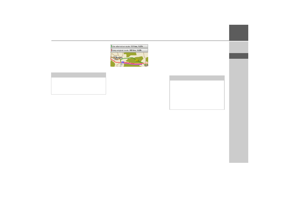
Manual recalculation
If a traffic announcement affects your
route, a window with detailed informa-
tion on the traffic announcement appears.
By selecting
Detour
you can specify
whether or not the message is to be taken
into account in the route calculation.
You can change your chosen setting at any
time in the message list.
If Becker® MAP PILOT determines that
a sensible detour is possible after you have
selected
Detour
, the following display
appears.
The display gives you an overview of the
calculated detour.
The route highlighted in red – and purple
if there is a traffic problem – shows the
previous route. The route highlighted in
green shows the calculated detour.
The remaining distance and the estimated
journey time for the previous route and
the detour are displayed at the top of the
display.
> Select the desired route.
The map display
The map display is used primarily for
route guidance. However, you can also use
the map display without route guidance to
show your current position and, for exam-
ple, to receive warnings about exceeding
the speed limit.
Note:
A detour is not generally calculated when
you select
Detour
. This is only done
when it is feasible in terms of time savings
and the route to be driven.
Note:
The map display can show signs (e.g.
speed limits). Please note that this is ad-
ditional information in the map data.
The reality may differ from those signs.
The traffic situation and the local road
signs take precedence over the navigation
system information.