Displaying the map legend – Pitney Bowes MapInfo ProViewer User Manual
Page 20
Full featured Pitney Bowes Software products allow you to determine the range (for example 0 to 3
miles, 2 to 5 miles) at which each layer is visible in a Map window.
2. To see the effect of zooming click the Zoom-in tool anywhere on the map. The map redraws at the
new zoom level. Notice that the information changes in the Zoom section of the Status Bar to reflect
a new zoom level.
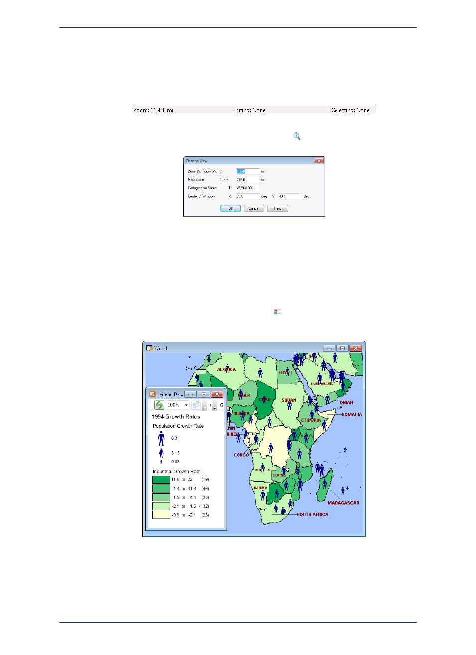
3. To specify the zoom level of the map, click the Change View
tool and enter a new zoom level.
At different zoom levels, new information displays on the map reflecting the visibility of the different
map layers that comprise WORLD.WOR.
Displaying the Map Legend
The map’s legend explains the meaning of the different shapes, colors, and fill patterns.
1. Open a Map window and click the Show/Hide Legend
tool or select the Options menu and the
Show/Hide Legend command.
Not all maps have legends.
Note:
2. Choose the Map menu option and the Previous View command to return the map from the beginning.
MapInfo ProViewer 12.5
20
A Brief Tour of the World.wor Workspace