Using the ruler tool, Using the zoom tools – Pitney Bowes MapInfo ProViewer User Manual
Page 19
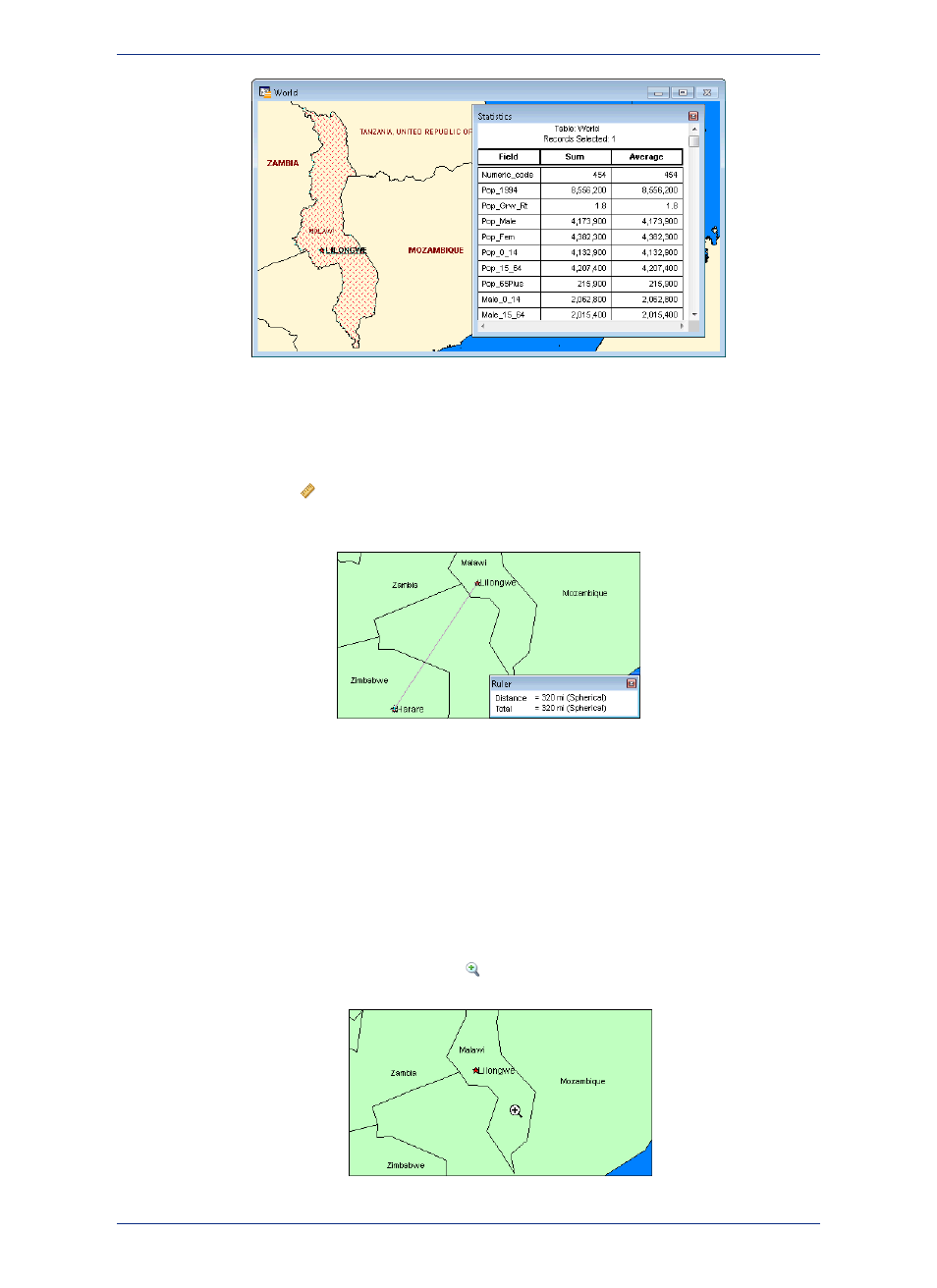
Using the Ruler Tool
The Ruler tool can show distance between two points on a Map window.
Choose the Ruler
tool and position the cursor, which displays as a cross, anywhere on the map
and click.
The Ruler window displays Distance and Total. As you move the cursor, the Distance measurement
changes in the Ruler window.
• To measure the distance between two points, click the first point and double-click the second.
• To measure the length of a path containing two or more segments, continue the process, clicking once
at the end of each segment to keep a running total of the length of the path.
Using the Zoom Tools
The zoom options give you control over the display of the Map window.
1. Open a Map window and click the Zoom-in
tool. Position the cursor anywhere on the map.
19
User Guide
Chapter 1: Introduction to MapInfo ProViewer