BendixKing KTA 910 System KTA 970 User Manual
Page 55
KTA 870/KMH 880 Pilot’s Guide
Rev 2
006-18265-0000
EGPWS Functions and Features
listed, or may display colors in slightly different densities than those list-
ed, but the system is designed to present the most appropriate Terrain
Display capable on the various display types which are usable by the
system.
NOTE: Green colors indicating terrain/obstacles below the aircraft are
NOT shown when the aircraft is on the ground, to reduce display clutter
and to show only terrain that is significantly higher than the aircraft in the
departure area. Green colors will appear when the aircraft has climbed
approximately 500 to 800 feet above the elevation of the runway.
The following pictures show two examples of the Terrain Display.
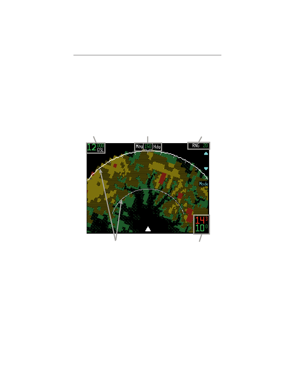
GA-EGPWS Terrain Display at 12,000 feet approaching Aspen, CO
47
Geometric Altitude
Displayed as MSL or GSL
Display Orientation
Here Magnetic Heading is
up and at 150°.
Display Range
Nautical Miles
Peaks Elevation
Maximum elevation
displayed over minimum
elevation. Here maximum
elevation is 14,300ft. and
minimum is 10,000ft.
Range Rings
Outer ring is selected
range, inner ring is half
the selected range. Here
outer ring is 20nm and the
inner ring is 10nm.