Navigation, Introduction – Mercedes-Benz SLK-Class 2009 COMAND Manual User Manual
Page 62
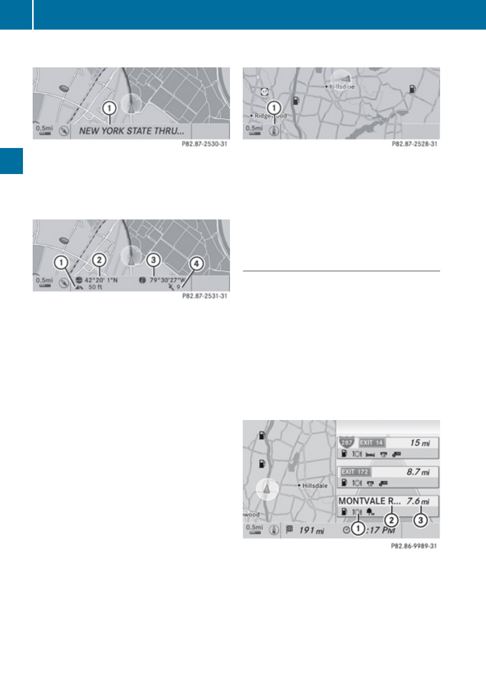
Current Street
Map with road display activated
1
Road name or road number, e.g. for
highways
Geo-Coordinates Display
Map with geo-coordinates display activated
1
Current height above sea level (rounded
off to 50 m)
2
Coordinates display of the current vehicle
location (latitude)
3
Coordinates display of the current vehicle
location (longitude)
4
Number of GPS satellites currently being
used.
i
Adequate GPS reception must be
available for all displays. The altitude
display 1 may differ from reality because
the navigation system calculates it using
the GPS signals.
i
In the Move Map function the display 1
and 4 are not displayed. The geo-
coordinate position of crosshairs is
displayed.
“None” Menu Option
Map with display switched off
1
Currently set map orientation
i
In the Move Map function you will see
other data depending on crosshairs
position, for example a road name if the
digital map supports this data.
Highway Information
When driving on highways, you can have the
next gas stations, service areas, etc. as well
as the distance to them displayed in the right-
hand half of the screen.
X
To set: Display menu system if applicable
X
Select Navi£Highway Information.
Depending on the previous status, the
function will be switched offcor on
Ç.
Example display: Function on
1
Information type: Rest area
2
Name of rest area
3
Distance from the current vehicle location
60
Introduction
Navigation