Navigation, Introduction – Mercedes-Benz E-Coupe 2010 COMAND Manual User Manual
Page 60
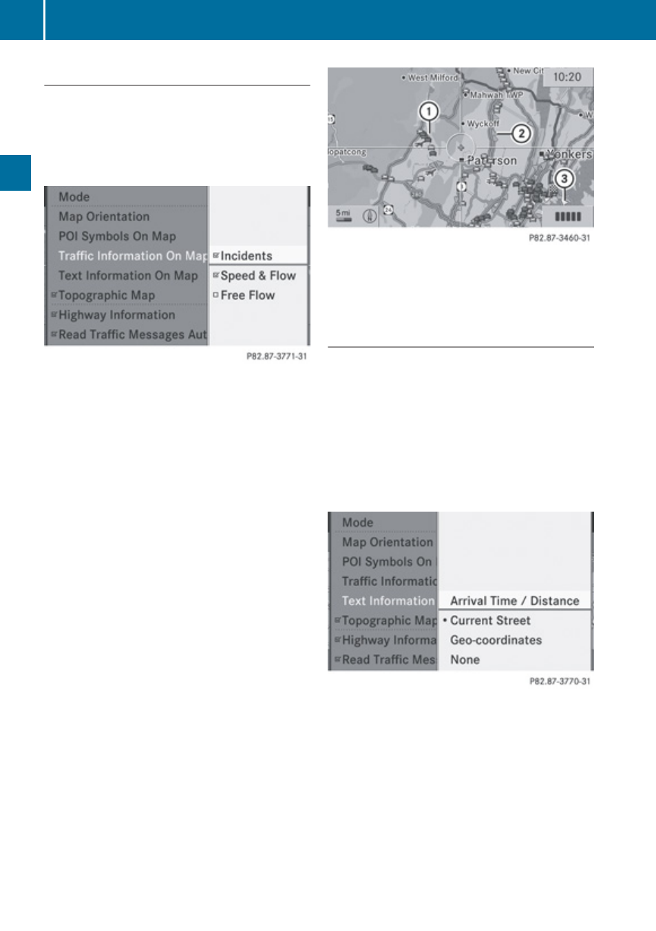
Traffic Information on Map
Provided you have a subscription to SIRIUS
XM Satellite Radio Traffic Message Service,
you can have the traffic information displayed
on the map. There are three different
categories of information you can select.
R
Incidents
Road sections marked by a yellow line =
with arrows: traffic slowdown possible due
to incidents (e.g. road work)
R
Speed and Flow
Road sections marked by yellow or red
cars :.
Yellow cars: Traffic congestion, average
speed 25
–
45
mph.
Red cars: Traffic congestion, average
speed 5
–
20
mph.
R
Free Flow
Road sections marked by a green line with
arrows ;: free flow of traffic.
1
Speed and Flow
2
Free Flow
3
Incidents
Text Information on Map
You can have map information displayed at
the bottom edge of the screen. By default the
map information is set to
Arrival Time/
Distance.
X
To set: Display menu system if applicable
X
Select
Navi£Text Information On
Map.
A dot R indicates the current setting.
X
Select
Arrival Time/Distance or
Current Street or Geo-coordinates or
None.
X
To exit menu: Slide
o
m
p
.
X
Hide menu system if applicable
(
58
Introduction
Navigation