Extension lines, Laylines – B&G Zeus 12 User Manual
Page 20
19
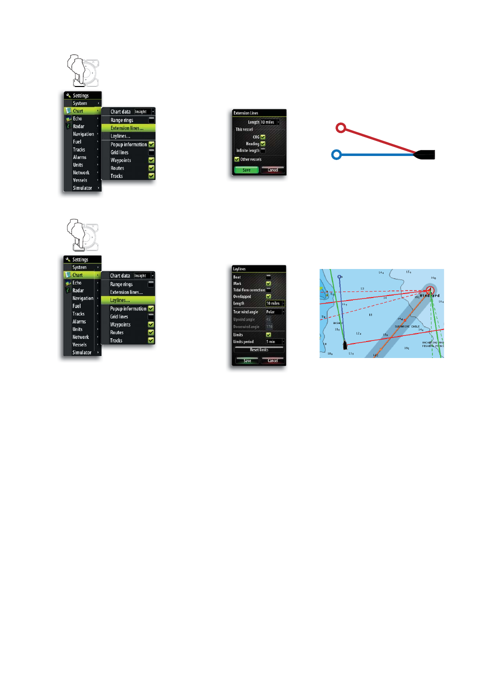
Extension Lines
The vessel’s extension lines can be activated to show course over ground (COG), heading
or both. The length of the line indicates either the distance selected or the distance that
the vessel will travel at the current speed in selected time period.
Selecting Infinite length will project a continuous extension line.
Laylines
When navigating to a waypoint you can configure laylines on the chart to aid navigation.
These lines can be set from the vessel, waypoint or both.
To configure the laylines go to the laylines menu.
Layline Options
MENU
WIN
x2
MENU
WIN
x2
COG
HEADING
Boat:
Layline from vessel. The length can be set to 1, 10 or 100
miles.
Mark:
Layline from mark/waypoint. The length can be set at 1, 10 or
100 miles.
If Boat & Mark are selected you cannot set the length as the
laylines join at the tack/gybe point where the laylines meet.
Tidal Flow Correction:
Tidal fl ow correction will calculate the tidal fl ow and offset the
laylines accordingly.
Overlapped:
When selected the laylines will extend beyond the tack/gybe
intersection.
True Wind Angle:
There are 3 sources available for true wind angle (TWA). You
can choose between Polar, Actual or Manual.
Polar:
Takes the target TWA from your polar table* (*Polar table is
available in Hercules Performance and Hercules Performance
Motion only).
Actual:
Takes the current value of true wind angle (TWA).
Manual:
Manually input the upwind and downwind numbers into the dia-
logue boxes.
Limits:
When selected will show a dotted line indicating the minimum
and maximum tack/gybe time period either side of the layline.
This can be set from 5 to 30 minutes.