60cx unit and microsd card, see – Garmin GPSMAP 60Cx User Manual
Page 55
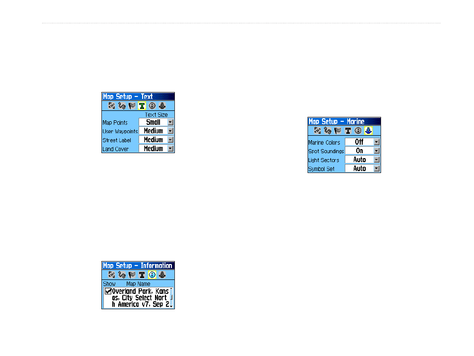
Map Setup – Text Page
Use the Text Page to select the text size for
descriptions of map items on the Map Page. Select
from None, Small, Medium, or Large.
Map Setup – Text Page
Map Setup – Information Page
The Text Page shows a list of downloaded detailed
maps such as topographic, marine charts, and
MapSource maps with auto-routing capability. Use
the ROCKER to highlight a map, and press ENTER
to show it on the map display or turn it off.
Press MENU to view the list of map display options.
Map Setup – Information Page
Map Setup – Marine Page
Use the Map Setup – Marine Page to customize
settings for Marine Colors, Spot Soundings, Light
Sectors, and Symbol Sets when using downloaded
marine charts (MapSource BlueChart marine mapping
data).
Map Setup – Marine Page
• Marine Colors—toggles marine colors on or
off on the Map Page.
• Spot Soundings—toggles spot soundings on or
off on the Map Page.
• Light Sectors—select Off, Auto, or ON.
• Symbol Set—select the symbol set to use.
(Auto, GARMIN, NOAA, or International)
GPSMAP 60Cx Owner’s Manual
M
AIn
P
Ages
>
M
AP
P
Age