Creating and using waypoints, Creating waypoints using the enter/mark key – Garmin GPSMAP 3005C User Manual
Page 20
GPSMAP 3005C Owner’s Manual
b
AsIc
o
PerAtIon
>
c
reAtIng
And
u
sIng
w
AyPoInts
4. Some items have a
Filter List button that allows you to enter letters or
numbers of the item name. The search result shows only items matching
the entered letters or numbers. Highlight the
Filter List button, and press
ENTER. Enter data, as needed, to narrow your search.
To find an item from another location on the map:
1. Open the Map Page. Use the
ROCKER to pan to the location you want,
and then press
FIND. The Find From (Location) Page appears.
2. Using the
ROCKER, highlight a category, and press ENTER.
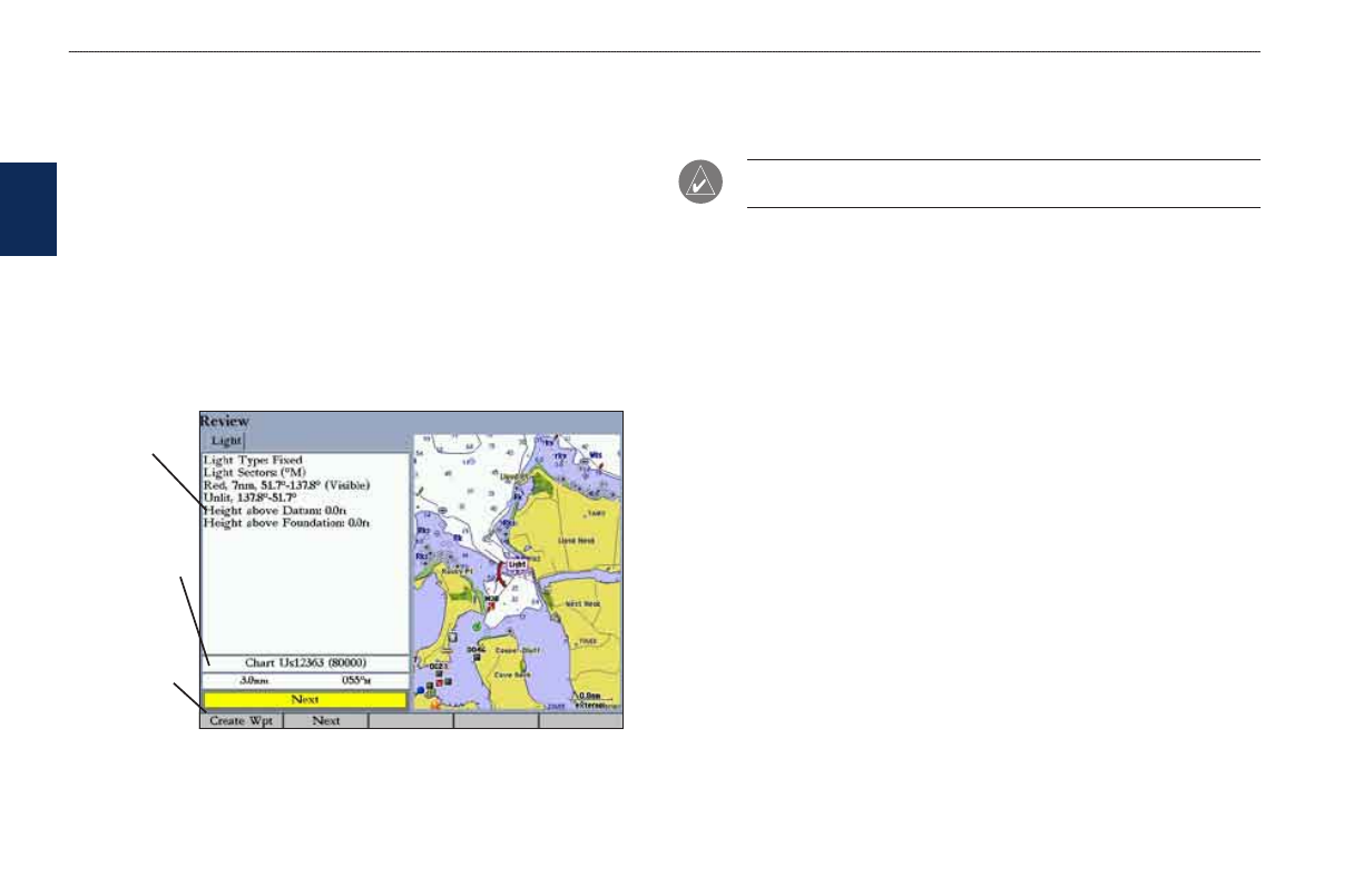
To view details about an item:
Highlight an item in the search results list, and press
ENTER. The Review
Page appears, showing item information, map location, chart name,
distance/bearing, and options for creating a waypoint or viewing the next
item in the search results list.
Item
nformaton
Dstance,
bearng,
chart name
of tem
Soft key
Creating and Using Waypoints
The GPSMAP 3005C stores up to 4,000 alphanumeric waypoints, each with a
user-defined icon, comment, depth, and water temperature.
NOTE: If you are using an optional Garmin GSD 20, GSD 21, or GSD 22
sounder module, the Depth and Water Temp fields fill in automatically.
You can create waypoints using three basic methods:
•
ENTER/MARK—use the ENTER/MARK key to quickly mark your
current location.
• Graphically—use the map display to define a new waypoint location.
• Manually—enter new waypoint coordinates manually.
Creating Waypoints Using the ENTER/MARK Key
Use the ENTER/MARK key to capture your current location (or pointer or map
item location) to create a new waypoint. You must have a valid position fix to
mark your current location.
To mark your current location:
1. Press and hold
ENTER/MARK until the Review Waypoint Page appears.
The GPSMAP 3005C captures its current location and creates a default
name and symbol for the new waypoint.
2. To accept the waypoint with the default name and symbol, press
ENTER.
To change any of the available waypoint information, see
b
as
Ic
o
pera
tIon