Nav key – Garmin GNC 300XL TSO User Manual
Page 30
20
Position page displaying ‘TOP’ VOR as the refer-
ence waypoint. This configuration can be used to
help monitor your distance and radial from a
waypoint of your choice. (NOTE: The waypoint
category is listed as ‘wpt’ rather than ‘vor’ because
the GNC 300XL is not using the nearest VOR.)
SECTION
1
NAV KEY
Reference Waypoints
& Satellite Status
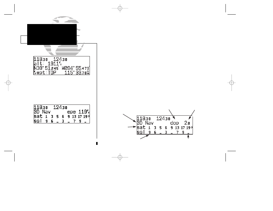
Satellite status page with ‘EPE’ displayed.
Estimated Position Error (EPE) gives an overall
measure of your position accuracy in feet or
meters.
3. Use
K
to choose which waypoint type you would like displayed. (Choose ‘wpt’ if you
would like range and bearing from a specific waypoint to be displayed.)
4. Press
C
to remove the cursor, or:
If you have selected ‘wpt’:
5. Rotate
O
to advance the cursor to highlight the identifier field.
6. Use the
K
and
O knobs to enter the identifier name. (This waypoint identifier can be
an airport, VOR, NDB, intersection, or user waypoint.) Press
E
.
7. Press
C
to confirm the selection.
This allows the distance and bearing from any waypoint to be displayed continu-
ously, which may be useful when an approach reference is not the closest navaid.
The GNC 300XL’s satellite status page provides satellite information to monitor
GPS coverage and receiver performance. This is helpful when you may be experienc-
ing low signal levels due to poor coverage or installation problems.
To view the satellite status page:
1. Press
N
and rotate
O
until the satellite status page appears.
Receiver Status
Signal strength of
satellite being tracked (1-9)
EPE/DOP
Satellites in view
EPE/DOP
value
Satellite in view
but not receiving signal
300xl manual 1/25/99 2:35 PM Page 20