Viewing aerial photos – Garmin GPSMAP 526s User Manual
Page 25
GPSMAP 400/500 Series Owner’s Manual
19
Using Charts
NOTE: When enabled, the high-resolution satellite images are only
present at lower zoom levels. If you cannot see the high-resolution
images in your BlueChart g2 Vision region, either zoom in further
using the
Range
(+) key, or set the detail level higher (
).
Photo Overlay Off
Land Only Photo Overlay
Photo Overlay at 50%
Photo Overlay at 100%
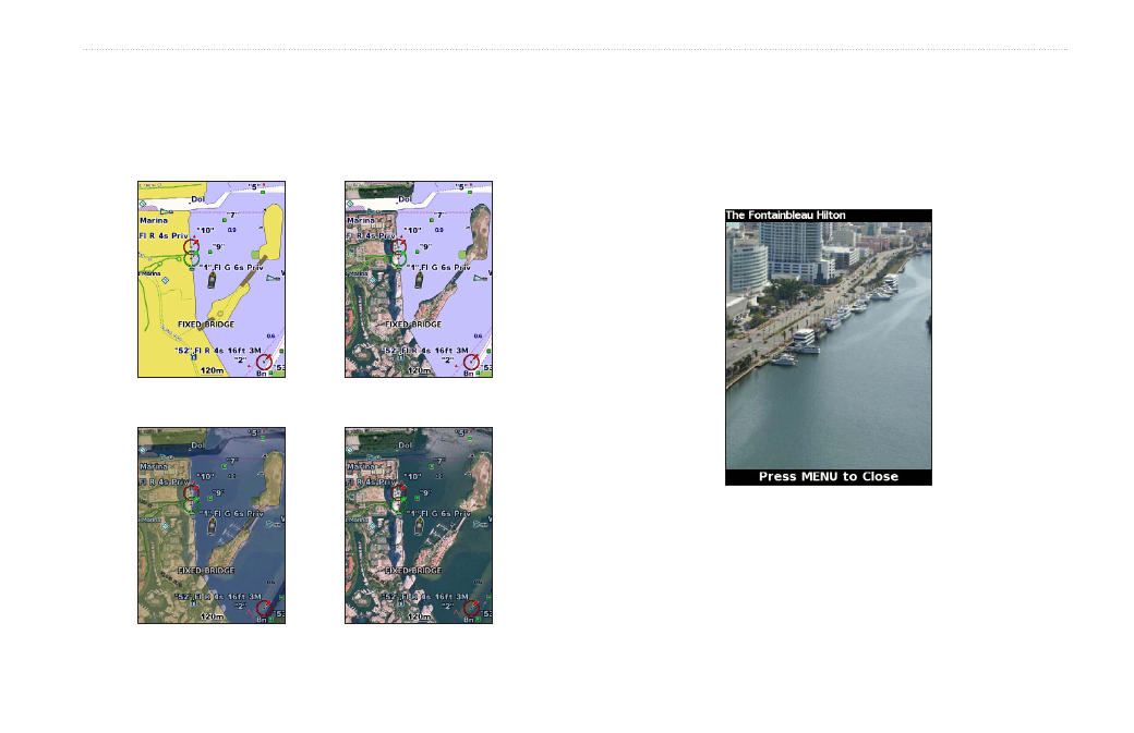
Viewing Aerial Photos
Preprogrammed BlueChart g2 Vision SD cards contain aerial
photographs of many landmarks, marinas, and harbors. Use these
photos to help orient yourself to your surroundings or to acquaint
yourself with a marina or a harbor prior to arrival.
Aerial Photo
NOTE: Use the
Range
(-/+) keys to zoom in and out while viewing
the aerial photo on the full screen.
- GMR 406 (26 pages)
- 340c (2 pages)
- GHP 10 (48 pages)
- GMR 1204 (14 pages)
- GMR24 Hd (12 pages)
- 190-00864-01 (24 pages)
- GFS 10 (24 pages)
- GMR 40 (32 pages)
- GMI 10 (8 pages)
- GMI 10 (20 pages)
- 240 (50 pages)
- Hiking Equipment (2 pages)
- GHS 10i (10 pages)
- G2 (24 pages)
- 100 BLUE (50 pages)
- GSD-20 (12 pages)
- GTX 320 ATC (24 pages)
- 80 (2 pages)
- GMR 41 (32 pages)
- 160 BLUE (50 pages)
- 250C (1 page)
- VHF 200 (10 pages)
- GPSMAP 2008 (124 pages)
- GMR 41 (26 pages)
- 160 (50 pages)
- Gxm 51 (10 pages)
- 160C (32 pages)
- Nuvi 900 (16 pages)
- GSD22 (8 pages)
- 90/140 (32 pages)
- VHF 200 (2 pages)
- Ghc 10 (28 pages)
- GSD 22 (10 pages)
- GPSMAP 3010C (2 pages)
- GPSMAP 3010C (130 pages)
- GPSMAP 76CSx (64 pages)
- GPSMAP 76CSx (2 pages)
- GPSMAP 76S (76 pages)
- GPSMAP 76S (18 pages)
- GPSMAP 172C (110 pages)
- GPSMAP 3005C (124 pages)
- GPSMAP 3005C (2 pages)
- GPSMAP 276C (2 pages)
- GTX 328 (10 pages)