Furuno color video plotter GD1720C User Manual
Page 78
3. PLOTTER OPERATION
3-7
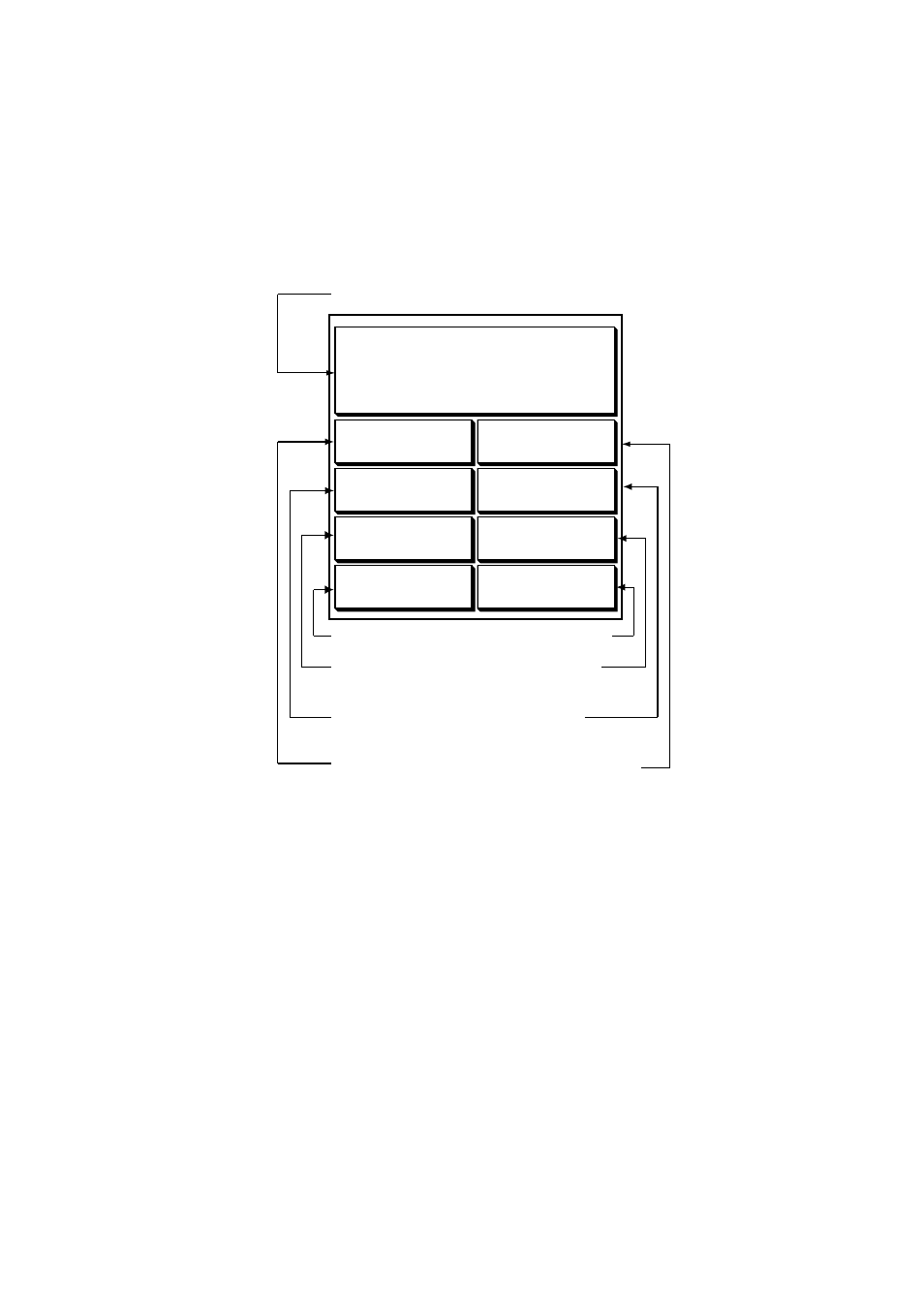
3.1.4 Nav data display
The nav data display provides comprehensive navigation data, and it is shown in a
three-screen combination display. The user may select what data to display and where to
display it. For details see the paragraph “7.8 Nav Data Display Setup.”
Appropriate sensors are required. Bars ( - -) appear when corresponding sensor is not
connected.
POSITION
34
°
34. 5678' N
120
°
34. 5678' W
SOG
WPT POSITION
COURSE
STW
10.0
kt
RANGE
BEARING
9.2
°
M
TEMP
DEPTH
Speed over ground
Position
Water temperature
Range to
waypoint
Course
Speed through
water
Bearing to
Waypoint
Waypoint
Position
Depth
34
°
14. 5678' N
120
°
14. 5678' W
10.0
kt
101.6
°
M
0.18
nm
1324.1
ft
18.2
°
C
Nav data displays
See also other documents in the category Furuno Sports and recreation:
- FAR-2805 Series (169 pages)
- FR-8062 (2 pages)
- FR-8122 (56 pages)
- CH-37 (90 pages)
- CH-37 (71 pages)
- FAR-2XX7 (4 pages)
- FAR-2XX7 (2 pages)
- FELCOM16 (4 pages)
- FRS-1000B (8 pages)
- FRS1000 (8 pages)
- Ls4100 (48 pages)
- 520 (73 pages)
- Marine Radar (24 pages)
- 1944C-BB (233 pages)
- 1733C (260 pages)
- FR-2105 (197 pages)
- FMD-8010 (50 pages)
- GD-1900C (260 pages)
- Black Box Video Sounder FCV-1200BB (2 pages)
- FR-1505 MARK-3 (4 pages)
- 1762 (252 pages)
- NAVnet DRS12A (44 pages)
- FAR-2137S (8 pages)
- FAR-2127 (136 pages)
- FA30 (6 pages)
- Satellite Compass SC-50/110 (30 pages)
- 1715 (2 pages)
- 1715 (48 pages)
- 1734C (55 pages)
- GD-1720C (53 pages)
- Mu 120c (2 pages)
- NAVNET GD-1920C (239 pages)
- CI-80 (41 pages)
- FAR-28x7 Series (299 pages)
- FAR-2837S (8 pages)
- BBWX1 (2 pages)
- 851 MARK-2 (37 pages)
- 851 MARK-2 (47 pages)
- BBFF3 (1 page)
- CSH-53 (106 pages)
- CSH-53 (108 pages)
- FCV295 (53 pages)
- FR1500 Mk3 (79 pages)
- FI-50 Series (2 pages)
- FCV-1150 (32 pages)