P.20, P. 20 – Acura 2012 TL - Advanced Technology Guide User Manual
Page 12
18
19
E n t e r i n g a D e s t i n a t i o n
N A V I G A T I O N
( T e c h / A d v a n c e )
Real-time navigation system uses GPS and a map database to show your
current location and help guide you to a desired destination.
Press and release the Talk button before you give a command.
U s i n g V o i c e C o n t r o l
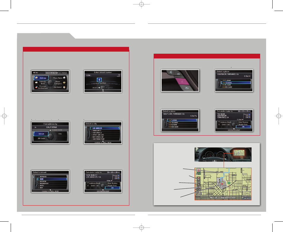
U s i n g t h e “ F i n d N e a r e s t ” C o m m a n d
Try these simple steps to find a nearby point of interest, such as a gas station, movie
theater, restaurant, etc.
Press and release the Talk button before you give a command.
1. Say “Find nearest ATM.”
2. A list of the nearest ATMs in
your area is displayed by
shortest distance to
destination.
3. Say the number next to the
destination you want to select.
4. The system calculates the
route and displays the
“Calculate route to” screen.
Say “OK” to set the route.
* You can also use the Interface Dial to complete this procedure.
* You can also use the Interface Dial to complete this procedure.
Calculated route
Distance to go
Time to go
Direction of destination
Current vehicle
location
M a p S c r e e n
L e g e n d
20
21
1. Say “Display menu” and
“Address.”
2. Say “Street,” then say the
street name on the next
screen. Do not include the
direction (N, S, E, W) or type
(St., Ave., Blvd., etc.).
3. A list of street names appears.
Say the number next to the
street you want.
4. Say the entire street address
number. For example, “1-2-3-4.”
5. If the street address is in
more than one city, a list of
city names appears. Say
the number next to the city
you want.
6. The system calculates the
route and displays the
“Calculate route to” screen.
Say “OK” to set the route.
12 TL ATG:ATG_NEW STYLE
1/27/2011
1:33 PM
Page 12