Mercedes-Benz C-Sedan OCS 2005 COMAND Manual User Manual
Page 177
117
Navigation
Route guidance
The navigation displays are only visible
while route guidance is active.
To switch to the navigation display from
another display, e.g. from CD operation:
̈
Press b or c.
Two examples are shown below:
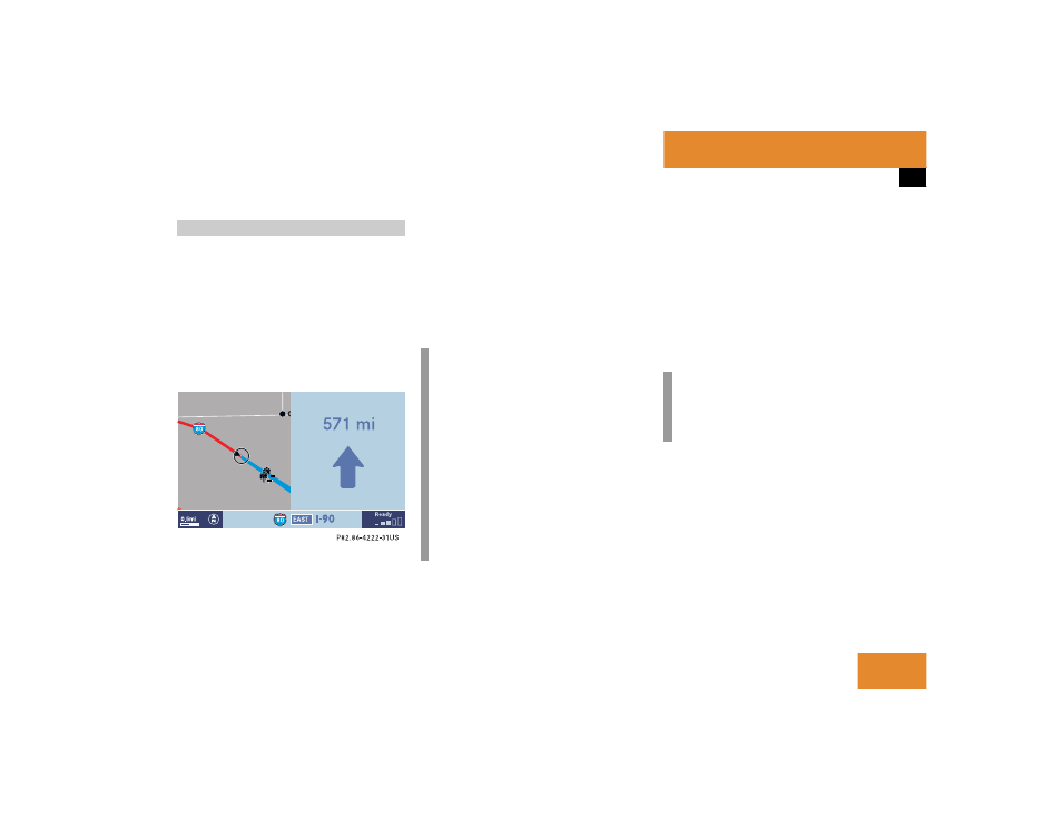
Display example 1:
The road you are currently driving on is
shown on the status bar, in this case
EAST I-90
. The indication
571 mi
is the
distance to the next driving maneuver.
If the GPS position display (
୴
page 130) is
active, the GPS data are shown instead of
the street name.
Important map symbols:
ț
Current vehicle location and direction
of travel y
If the map orientation
Heading Up
(
୴
page 130) is chosen, the arrow will
always point upward.
ț
The remaining route section is
highlighted in blue color.
Navigation displays
i
Using the control system, the display
unit can be changed between km or
miles (see your vehicle’s Operator’s
Manual).
ț
When the display unit is set to
miles, the COMAND will indicate
distances in miles (mi) or feet (ft).
ț
When the display unit is set to km,
the COMAND will indicate
distances in kilometers (km) or
meters (m).
i
The colored highlight only appears
when the system has completed the
route calculation.