Mercedes-Benz R-Class 2007 COMAND Manual User Manual
Page 178
176
Navigation*
Route guidance
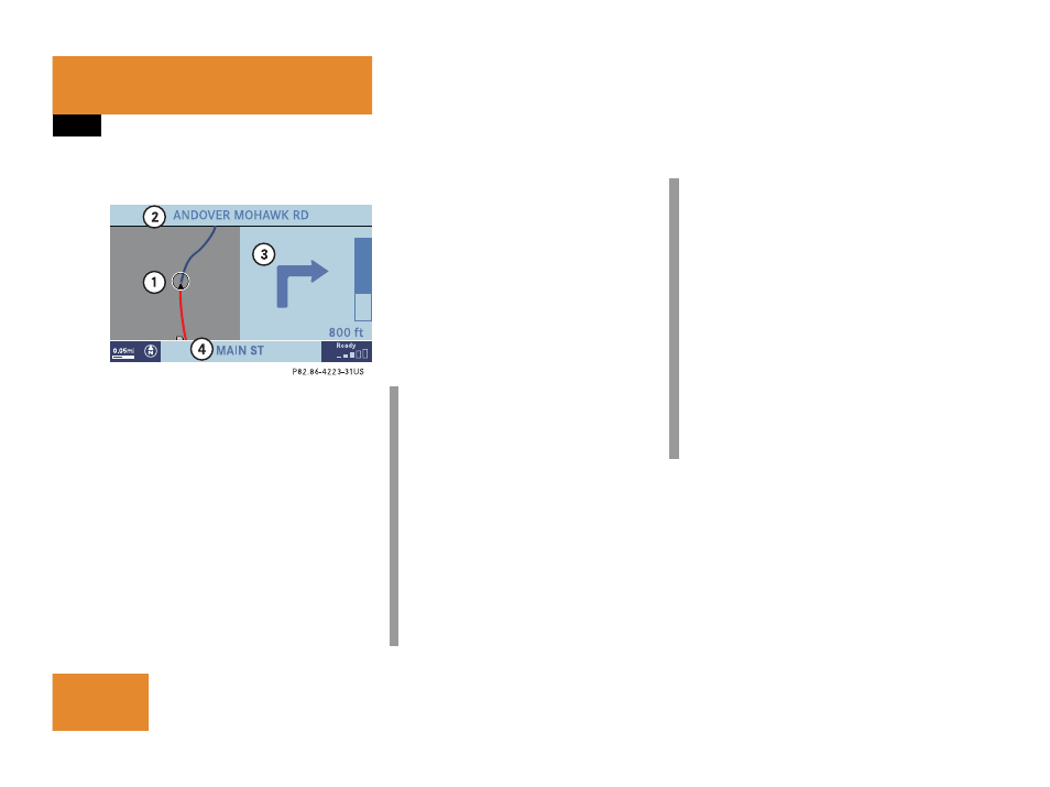
Display example 2:
1 Current vehicle location and direction
of travel
y, remaining route section
2 Name of the road you are to turn onto
3 Symbol for the next driving maneuver,
distance bar and distance to the next
driving maneuver
4 The road you are currently driving on
In the right half of the display, the symbol
for the next driving maneuver is indicated
(here: right turn).
On the very right side of the display next to
the turn symbol is the distance bar. It
indicates the distance to the next driving
maneuver (here: 800 ft).
The status bar shows the name of the
street after the driving maneuver, if
available, here:
MAIN ST
The destination is marked with a flag
$ on
the map, an intermediate destination is
marked with a flag showing the letter
S
.
i
If full view of map is displayed:
Status bar
4 indicates one of the
following depending on which option is
selected in the Display in Map screen
(
୴
page 194)
ț
the estimated time of arrival and
the distance to destination
ț
GPS coordinates of the current
position or
ț
the road you are currently driving
on
i
Using the control system, the display
unit can be changed between km or
miles (see your vehicle’s Operator’s
Manual).
ț
When the instrument cluster
multifunction display is set to miles,
the COMAND will indicate
distances in miles (mi) or feet (ft)
ț
When the instrument cluster
multifunction display is set to
kilometers, the COMAND will
indicate distances in kilometers
(km) or meters (m)