Operator’s manual, Markers – Great Plains DICKEY-john AI100 10-inch Virtual Terminal User Manual
Page 62
OPERATOR’S MANUAL
10" Virtual Terminal
11001-1440-200701
60 / TASK CONTROLLER
MARKERS
Markers are used to record the GPS location of a particular condition that
has occurred in the field. A marker can only be enabled when a Task is
operating. When a marker is enabled, GPS coordinates are saved to the SD
Card with a date stamp and geological point.
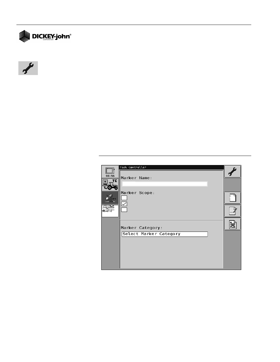
To create a marker:
1. From the Task Controller Main screen, press the Maintenance button.
2. At the Maintenance screen, press the Markers selection box
(
Figure 54
).
3. At the Marker Setup screen, press the Marker Name selection box to
enable the keypad and enter a Name. A Marker Name and Marker
Scope are required entries.
4. Select a Marker Scope as either Point, Continuous, or Global.
5. To enter an optional Marker Category or Subtype, press the selection
box to enable the keypad and enter data.
6. Press the Maintenance button to accept and return to the
Maintenance screen.
Figure 56
Add New Marker screen
MARKER NAME
Marker Name is a required entry that will appear on the Marker Setup
screen or Task screen during operation to allow selection when creating a
marker. A name should be selected that provides specific detail of what
condition is occuring when the marker is enabled.
wet area
Point
Continuous
Global
Add New Marker
* required
* required
Maintenance button