Viewing aerial photos, Turns camera icons – Garmin GPSMAP 546s User Manual
Page 25
Using Charts
GPSMAP 400/500 Series Owner’s Manual
19
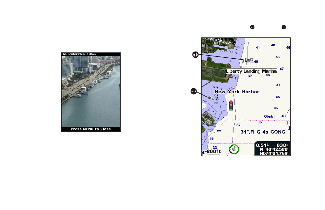
Viewing Aerial Photos
Preprogrammed BlueChart g2 Vision SD cards contain aerial photographs
of many landmarks, marinas, and harbors. Use these photos to help orient
yourself to your surroundings or to acquaint yourself with a marina or a harbor
prior to arrival.
NOTE: Use the Range (-/+) keys to zoom in and out while viewing the aerial
photo on the full screen.
To access aerial photos from the navigation chart:
Use the Rocker to highlight an overhead
➊
or perspective
➋
camera icon
with the pointer, and select aerial Photo or Review > aerial Photo.
➊
➋
See also other documents in the category Garmin Sports and recreation:
- GMR 406 (26 pages)
- 340c (2 pages)
- GHP 10 (48 pages)
- GMR 1204 (14 pages)
- GMR24 Hd (12 pages)
- 190-00864-01 (24 pages)
- GFS 10 (24 pages)
- GMR 40 (32 pages)
- GMI 10 (8 pages)
- GMI 10 (20 pages)
- 240 (50 pages)
- Hiking Equipment (2 pages)
- GHS 10i (10 pages)
- G2 (24 pages)
- 100 BLUE (50 pages)
- GSD-20 (12 pages)
- GTX 320 ATC (24 pages)
- 80 (2 pages)
- GMR 41 (32 pages)
- 160 BLUE (50 pages)
- 250C (1 page)
- VHF 200 (10 pages)
- GPSMAP 2008 (124 pages)
- GMR 41 (26 pages)
- 160 (50 pages)
- Gxm 51 (10 pages)
- 160C (32 pages)
- Nuvi 900 (16 pages)
- GSD22 (8 pages)
- 90/140 (32 pages)
- VHF 200 (2 pages)
- Ghc 10 (28 pages)
- GSD 22 (10 pages)
- GPSMAP 3010C (130 pages)
- GPSMAP 3010C (2 pages)
- GPSMAP 76CSx (64 pages)
- GPSMAP 76CSx (2 pages)
- GPSMAP 76S (76 pages)
- GPSMAP 76S (18 pages)
- GPSMAP 172C (110 pages)
- GPSMAP 3005C (2 pages)
- GPSMAP 3005C (124 pages)
- GPSMAP 276C (2 pages)
- GTX 328 (10 pages)
- GPSMAP 526s (84 pages)