4 airport frequency page – Garmin GNC 420 User Manual
Page 116
GNC 420(A) Pilot’s Guide and Reference
7-6
SECTION 7
WPT PAGES
Adjusting the range of the map image:
1) Press the down arrow of the RNG Key to
display a smaller map area.
2) Press the up arrow of the RNG Key to display
a larger map area.
The following descriptions and abbreviations are used
on the Airport Runway Page:
• Type - Usage type: Public, Heliport, Military, or
Private
• Surface - Runway surface types include: Hard,
Turf, Sealed, Gravel, Dirt, Soft, Unknown, or
Water
• Lighting - Runway lighting types include: No
Lights, Part Time, Full Time, Unknown, or
Frequency (for pilot-controlled lighting)
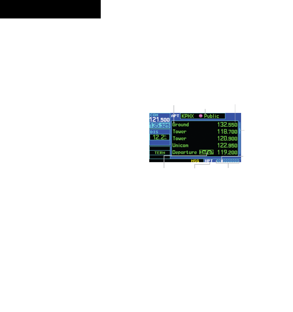
7.4 AIRPORT FREQUENCy PAGE
The Airport Frequency Page displays radio frequencies
and frequency types for the selected airport, as well as
sector and altitude restrictions (where applicable). If
the selected airport has an ILS approach, the localizer
frequency(ies) are also listed on the Airport Frequency
Page (Figure 7-12). The Airport Frequency Page may be
used to quickly select and tune a COM frequency. VLOC
frequency is for reference only.
Figure 7-12 Airport Frequency Page
Airport Identifier,
Symbol, and Type
Frequency
Frequency Type
Scroll
Bar
Usage Restrictions
Information
Number of Pages in
Current Page Group
Position of
Current Page
within Current
Page Group
Current Page
Group
Scrolling through the frequency list and
tune to a desired frequency on the list:
1) Press the small right knob to activate the
cursor.
190-00140-20 Rev. K