What can i see, Using the 3d chart – Raymarine GPS Kit User Manual
Page 11
?
More information ...
See 'Using the 3D Chart' chapter of the Reference Manual.
How do I change the motion mode?
Using aerial photographs
Planning mode:
To view an area of the chart you are not currently in.
The boat may not remain on the screen.
The aerial photograph overlay helps you to
interpret features in your environment. This
option is accessed via the 3D Chart Setup menu.
To change to planning mode and pan to the area of
the 3D chart you want to view:
Active motion mode
Default mode when 3D chart opened and there is a
valid fix. Shows aerial view from above your boat.
What can I see?
Using the 3D chart ...
Card No. 10
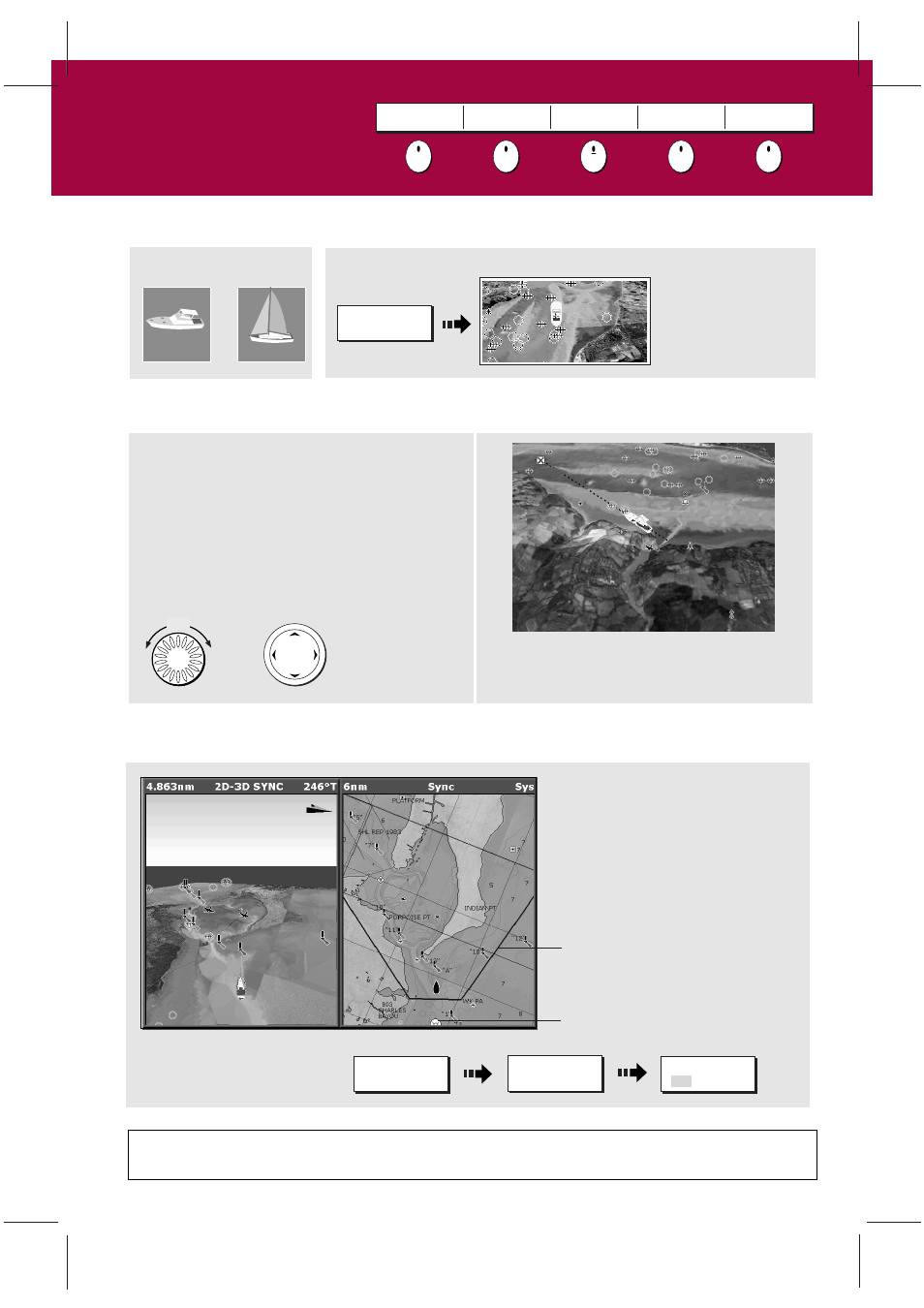
How do I find where I am on the 3D chart?
If you cannot see your boat symbol:
Synchronize 3D chart with 2D chart
D8736_1
Your position:
Turn
The 3D chart automat-
ically redraws with the
boat in forward looking
view at your current
position.
FIND SHIP
GOTO
ADJUST ON
EYE CENTRE
ADJUST
ROTATE PITCH
PRESENTATION
Or
Or
FIND SHIP
With a 2D chart window active,
synchronise 3D to 2D chart:
3D location
Eye point
Note: When multiple windows are
displayed and the current window
is set to SYSTEM, changes made to
the chart are reflected in all
windows. If set to LOCAL no other
window is affected.
PRESENTATION...
CHART MODE AND
ORIENTATION...
CHART SYNC
RDR 3D OFF