3d map screen – Navman iCN 500 series User Manual
Page 51
51
iCN 500 series | User Manual
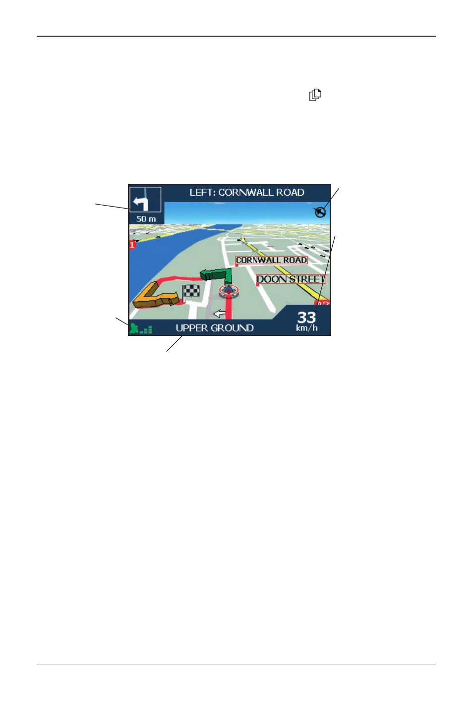
3D Map Screen
The 3D Map screen displays when a route is calculated, oriented to the travelling direction with an
adjustable horizon.
To view the 3D Map screen when a route has been calculated, press
to cycle through the screens.
• To adjust the viewing angle, press the 4-way toggle up or down.
• To display a smaller area in greater detail, press +.
• To display a larger area in less detail, press -.
• To display the Go To Pop-up summary, press the 4-way toggle.
GPS strength indicator.
Tap to display the Satellite
Signal Strengths screen.
North-oriented compass
Additional information can
display here. Tap to scroll the
options. You must have a
route calculated to view these
options:
• Speed
• Time
• Heading
• Distance to Turn
• Distance to Go
• ETA (Estimated Time of
Arrival)
• Time to Go
Direction of the next turn.
Tap to hear next
instruction.
Your current location.
Tap to display the Main Menu screen.