Using the 2d map screen to plan a route, Get tin g s ta rte d – Navman SmartS iCN530 User Manual
Page 23
23
iCN 530 | User Manual
G
et
tin
g s
ta
rte
d
5. Using the 2D Map screen to
Plan a Route
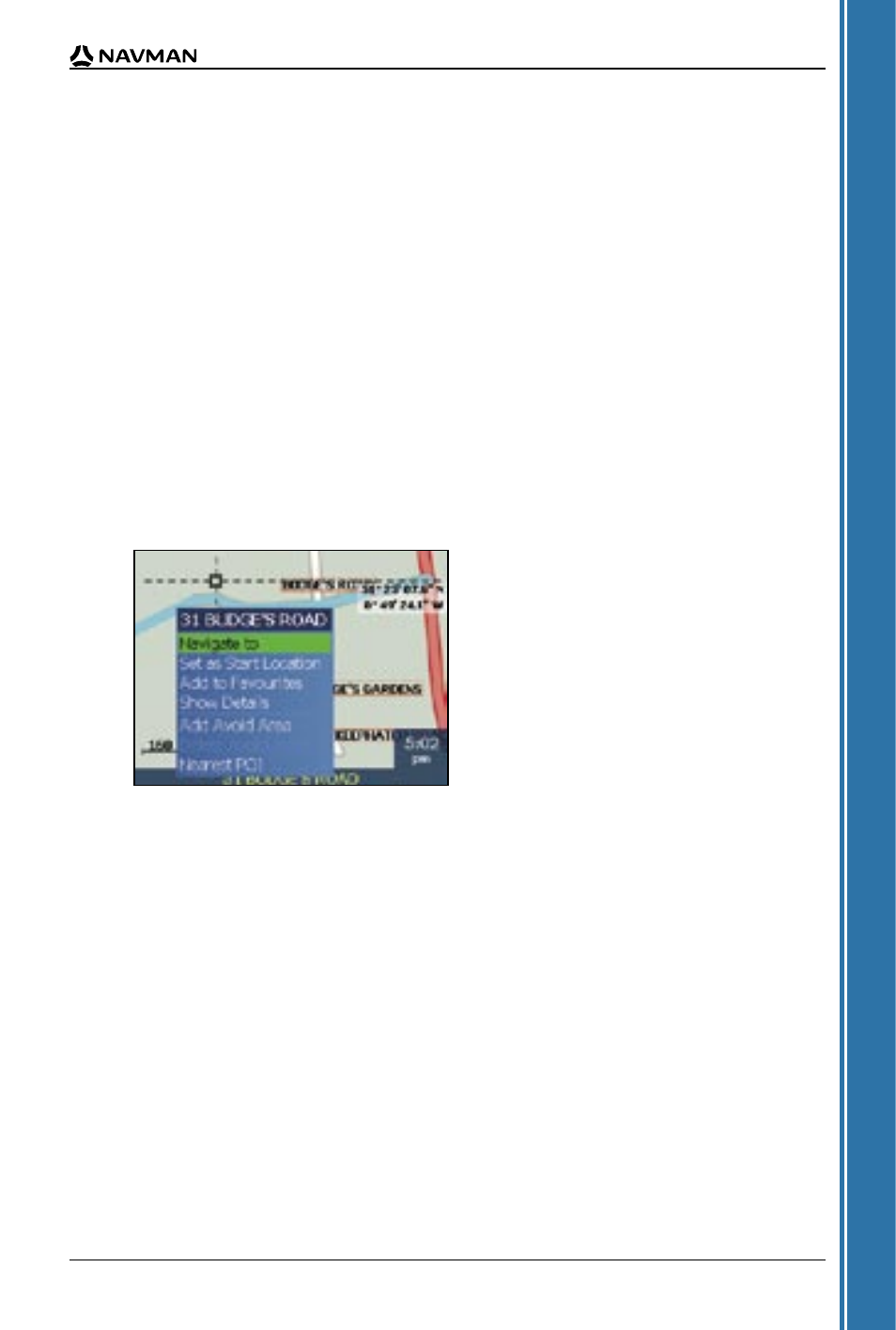
You can plan a route directly from the 2D Map screen using the Pop-up menu.
1. From the Main Menu, tap Map.
The 2D Map screen will display.
• Move around the 2D Map screen using the stylus.
5. Select Navigate to.
The route is calculated and displayed on the 3D Map screen.
2. Tap the Map screen to display the cross-hairs.
• To remove the cross-hairs press ESC.
3. Drag the intersection of the cross-hairs to a destination. Where the cross-hairs intersect on a
street, the street will highlight and the street name will display.
4. Tap the intersection of the cross-hairs to select the street as your destination.
The Pop-up menu will display.
• To display the zoom options, tap
.
• To display a smaller area in greater detail (zoom in), tap
.
• To display a larger area in less detail (zoom out), tap
.
- 12 (90 pages)
- B10 (19 pages)
- 5505 (68 pages)
- iCN 620 (106 pages)
- JUPITER LA000267 (26 pages)
- F-Series (24 pages)
- F30 (24 pages)
- N60i (2 pages)
- Sport Tool M300 (26 pages)
- GPS 3450 (8 pages)
- iCN 630 (8 pages)
- iCN 510 (92 pages)
- iCN 500 series (100 pages)
- F10 (90 pages)
- TRACKER950 (41 pages)
- iCN Series (8 pages)
- F25 (70 pages)
- PiN 570 (116 pages)
- Smart 2005 (68 pages)
- N-Series (144 pages)
- F20 (10 pages)
- LA000507 (16 pages)
- LA000578A (17 pages)
- SmartST Professional (60 pages)
- Smart V3 (53 pages)
- ICN 330 (16 pages)
- 5380 (64 pages)
- iCN-700 Series (128 pages)
- TRACKER 5100 (42 pages)
- VHF 7200 (60 pages)
- Sport Tool W300 (26 pages)
- M-Nav 650 (84 pages)
- 3100 (16 pages)
- ICN 550 (72 pages)
- 5605 (68 pages)
- iCN 600series (41 pages)
- 2 (6 pages)
- GPS 4400 (8 pages)
- Tracker500/500i (44 pages)
- LA000508 (18 pages)
- tracker plotter TRACKER 5600 (42 pages)
- iCN700 (124 pages)
- S-Series (133 pages)
- 630 (8 pages)