Using the 2d map screen to plan a route, Get tin g s ta rte d – Navman Smart 2005 User Manual
Page 29
29
Smart 2005 for Pocket PC | User Manual
G
et
tin
g s
ta
rte
d
10. Using the 2D Map Screen to
Plan a Route
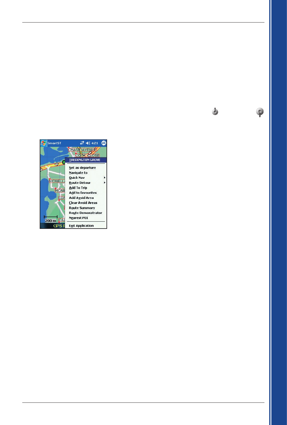
You can plan a route directly from the 2D Map screen using the Pop-up menu.
For more information on the Pop-up Menu, see page 39.
1. From the Main Menu, tap Map.
The 2D Map screen will display.
2. Scroll the map by dragging the stylus, then lifting it off the map. Repeat until your destination is visible.
• Zoom in or out of the map as required to locate your destination, using to zoom in and
to zoom out.
3. Tap and hold the road or POI icon that represents your destination.
The Pop-up Menu will display.
4. Select Navigate to from the Pop-up menu.
Smart will calculate and display the route to your destination.
See also other documents in the category Navman GPS receiver:
- 12 (90 pages)
- B10 (19 pages)
- 5505 (68 pages)
- iCN 620 (106 pages)
- JUPITER LA000267 (26 pages)
- F-Series (24 pages)
- F30 (24 pages)
- SmartS iCN530 (72 pages)
- N60i (2 pages)
- Sport Tool M300 (26 pages)
- GPS 3450 (8 pages)
- iCN 630 (8 pages)
- iCN 510 (92 pages)
- iCN 500 series (100 pages)
- F10 (90 pages)
- TRACKER950 (41 pages)
- iCN Series (8 pages)
- F25 (70 pages)
- PiN 570 (116 pages)
- N-Series (144 pages)
- F20 (10 pages)
- LA000507 (16 pages)
- LA000578A (17 pages)
- SmartST Professional (60 pages)
- Smart V3 (53 pages)
- ICN 330 (16 pages)
- 5380 (64 pages)
- iCN-700 Series (128 pages)
- TRACKER 5100 (42 pages)
- VHF 7200 (60 pages)
- Sport Tool W300 (26 pages)
- M-Nav 650 (84 pages)
- 3100 (16 pages)
- ICN 550 (72 pages)
- 5605 (68 pages)
- iCN 600series (41 pages)
- 2 (6 pages)
- GPS 4400 (8 pages)
- Tracker500/500i (44 pages)
- LA000508 (18 pages)
- tracker plotter TRACKER 5600 (42 pages)
- iCN700 (124 pages)
- S-Series (133 pages)
- 630 (8 pages)