Fishing chart, Showing satellite imagery on the navigation chart, Showing satellite imagery on the – Garmin GPSMAP 740s User Manual
Page 23: Navigation chart
GPSMAP 700 Series Owner’s Manual
19
Charts and 3D Chart Views
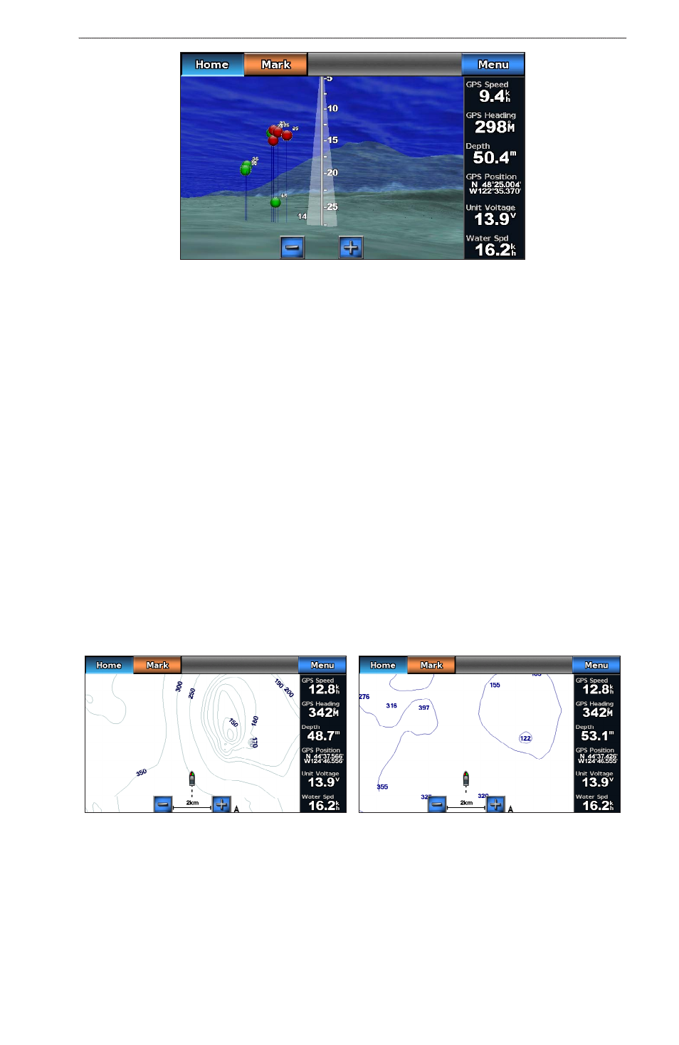
Fish Eye 3D with a Sonar Cone
Adjusting the View
See “Adjusting the View” (
).
Fish Eye 3D Chart Appearance
Indicating the Direction of the Fish Eye 3-D Chart View
1. From the Home screen, select Charts > Fish eye 3D > Menu > View.
2. Select Fore, Aft, Port, or Starboard.
Showing a Sonar Cone on the Chart
You can show a cone that indicates the area covered by your transducer.
From the Home screen, select Charts > Fish eye 3D > Menu > Sonar Cone > on.
Showing Suspended Targets
From the Home screen, select Charts > Fish eye 3D > Menu > Fish Symbols > on.
Showing Tracks
From the Home screen, select Charts > Fish eye 3D > Menu > Tracks > on.
Showing Overlay Numbers
).
Fishing Chart
Use the Fishing chart for a detailed view of the bottom contours and depth soundings on the chart.
Navigation Chart
Fishing Chart
The Fishing chart uses detailed bathymetric data, and is best for offshore deep-sea fishing.
Fishing Chart Appearance
Using Waypoints
See “Waypoints” (
).