Fish eye 3d, Provides an underwater – Garmin GPSMAP 740s User Manual
Page 22
18
GPSMAP 700 Series Owner’s Manual
Charts and 3D Chart Views
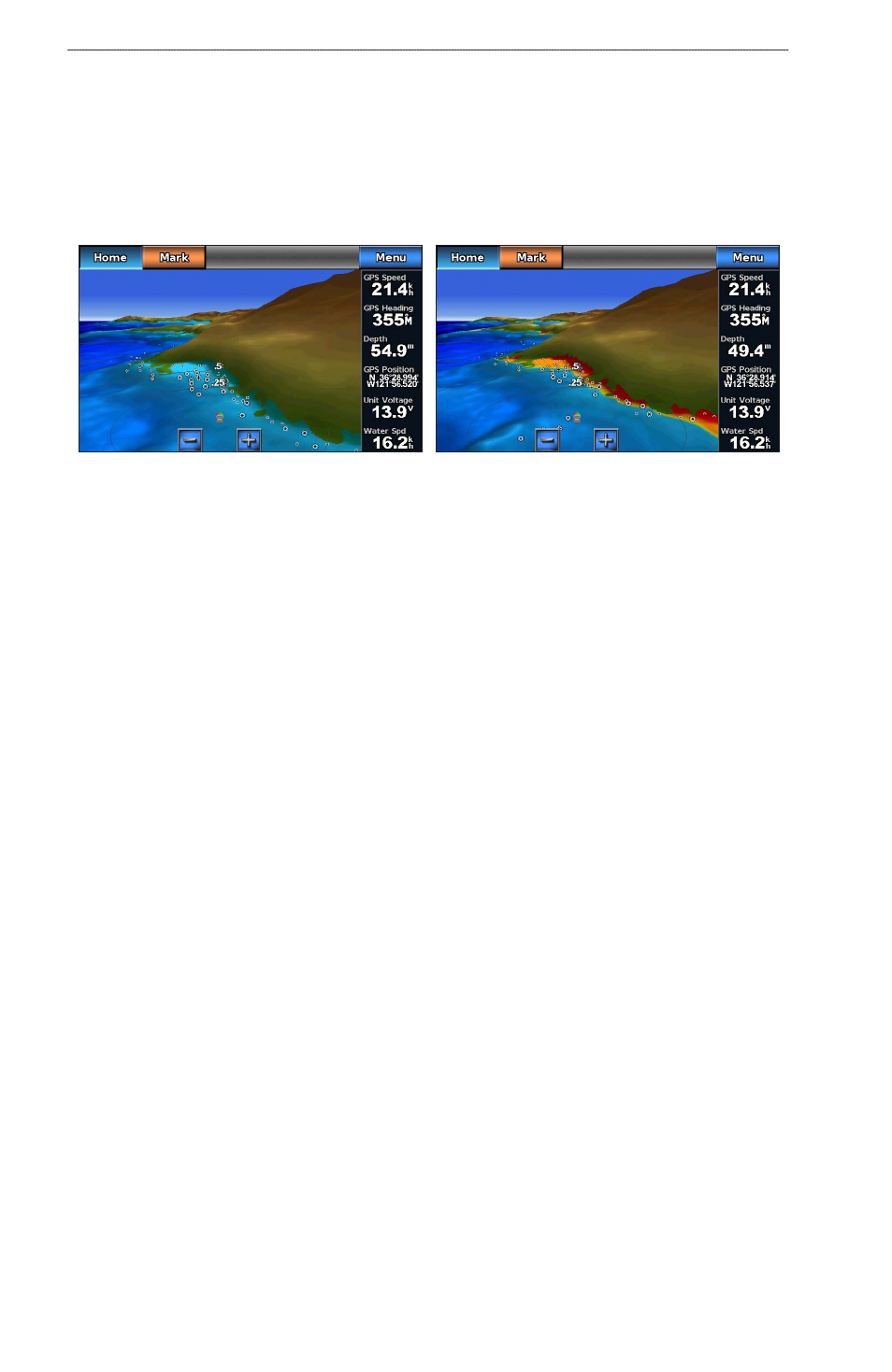
Showing or Hiding Hazard Colors
1. From the Home screen, select Charts > Mariner’s eye 3D > Menu > Chart Appearance > Hazard
Colors.
2. Complete an action:
• Select on to view shallow water and land with a color scale. Blue indicates deep water, yellow is
shallow water, and red is very shallow water.
• Select off to view the land as seen from the water.
Mariner’s Eye 3D, Hazard Colors Off
Mariner’s Eye 3D, Hazard Colors On
Showing Range Rings
See “Showing Range Rings” (
).
Selecting a Safe Depth
You can set the appearance of a safe depth for Mariner’s Eye 3D.
NoTe: This setting affects only the appearance of hazard colors in Mariner’s Eye 3D. It does not affect the
safe water depth Auto Guidance setting (
) or the sonar shallow water alarm setting
1. From the Home screen, select Charts > Mariner’s eye 3D > Menu > Chart Appearance > Safe Depth.
2. Enter the depth.
3. Select Done.
Selecting a Lane Width
See “Selecting a Lane Width” (
).
Showing Other Vessels
See “Configuring the Appearance of Other Vessels” (
Showing and Configuring Overlay Numbers
Using Waypoints and Tracks
See “Waypoints” (
) or “Tracks” (
Fish Eye 3D
Using the depth contour lines of the BlueChart g2 Vision cartography, Fish Eye 3D provides an underwater
view of the sea floor or lake bottom.
When a sonar transducer is connected, suspended targets (such as fish) are indicated by red, green, and yellow
spheres. Red indicates the largest targets and green indicates the smallest.