Specifications, Sp-1 – Furuno RP-25 User Manual
Page 48
SP-1
SPECIFICATIONS
Radar Plotter
Radar Map
Display
Radar Display, Video Plotter display,
Radar/Video Plotter display
Radar display only
Display Mode
HU*, TM, CU, NU, CG
(No chart available in HU and CG mode)
*Not available in G-type.
HU, TM, CU, NU, CG
Display Range
0.125/0.25/0.5/0.75/1/1.5/2/3/4/6/8/12/16/24/32/48/72/96*/120*
*FR/FAR-2825 only
Projection Mercator
Ichnography
Useable Range
80ْ latitude or below
Electronic Chart Card Land features filled
-
Track Capacity
Own ship: 6,000 points
Other ship: 6,000 points
Own ship plot interval:
OFF/10sec/30sec/1min/2min/3min/6min
-
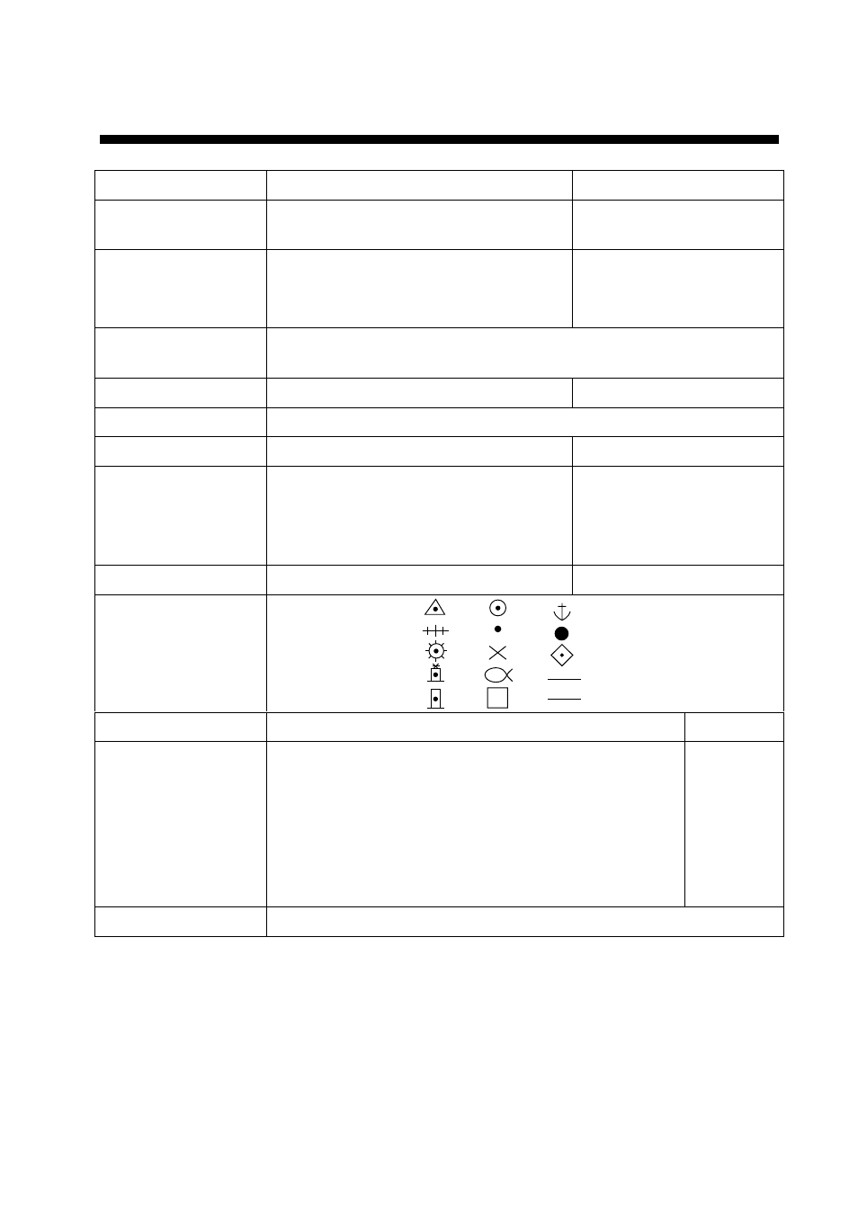
Marks
Mark capacity: 6,000 points
Mark capacity: 1,500 points
Nav Line
Coast line
Contour line
Prohibited line
Cable
Course Line
Internal setting or external input from navaid.
-
Data Display (requires
external sensors)
٠ Own ship’s latitude and longitude position
٠ Cursor latitude and longitude position
٠ Range/bearing, estimated time to arrive to waypoint
٠ Range and bearing from origin mark to cursor
٠ Depth
٠ Water temperature
-
Alarm Arrival
alarm
(audible)