AvMap A2 ADAHRS User Manual
Page 13
12
- User and Installation Manual
AvMap
A
2
ADAHRS
User and Installation Manual -
13
AvMap
A
2
ADAHRS
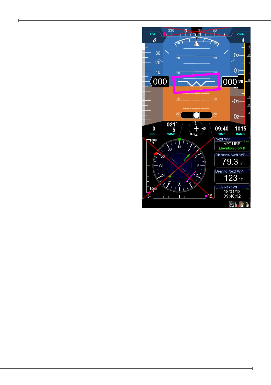
To start the guided procedure select MENU >
TOOLS > EFIS > Compass Calibration.
After starting the procedure the screen
switches to Primary Flight Display mode,
where a flight director (i.e. magenta box)
shows the maneuvers to perform. Follow the
magenta box until the procedure is finished.
Assuming the calibration is started with the
aircraft heading North, the steps required are:
1. Maintaining heading 000° execute: pitch
up + 20°, back to straight flight and then
pitch down -20°
2. Turn left to heading 270° by performing
a standard rate turn (the proper bank
will be shown by the flight director). The
target heading for each step is shown as
a magenta reference inside the heading
tape.
3. Execute pitch up/down maneuvers as
described in step #1
4. Repeat steps #2 and #3 for headings 180°
and 090°, until reaching again the original
heading.
At the end of a successful calibration
procedures the compass instruments is
enabled (i.e. red cross removed) and the HSI
instrument correctly shows AHRS as data
source, meaning that magnetic compass data
are now available to the EFIS system.
Note: it’s not required to start the procedure
heading north. Any starting direction is
acceptable.
Note: If the calibration fails or the compass
indicator is not enabled, repeat the calibration
procedure. If several calibration attempts
fails review the installation location of the A2.
Magnetic disturbance could be too high in the
area selected.
Figure 10