Bendix Commercial Vehicle Systems Bendix/King Global Positioning System KLN 35A User Manual
Page 126
4.4.2.
CREATING A WAYPOINT AT A CERTAIN
LATITUDE/LONGITUDE
It is also possible to create a user-defined waypoint by manually
entering a latitude and longitude. Let's say you wanted to create a
user waypoint over your farm at N 42°56.32', W 76°29.95'
To create a user-defined waypoint with latitude/longitude:
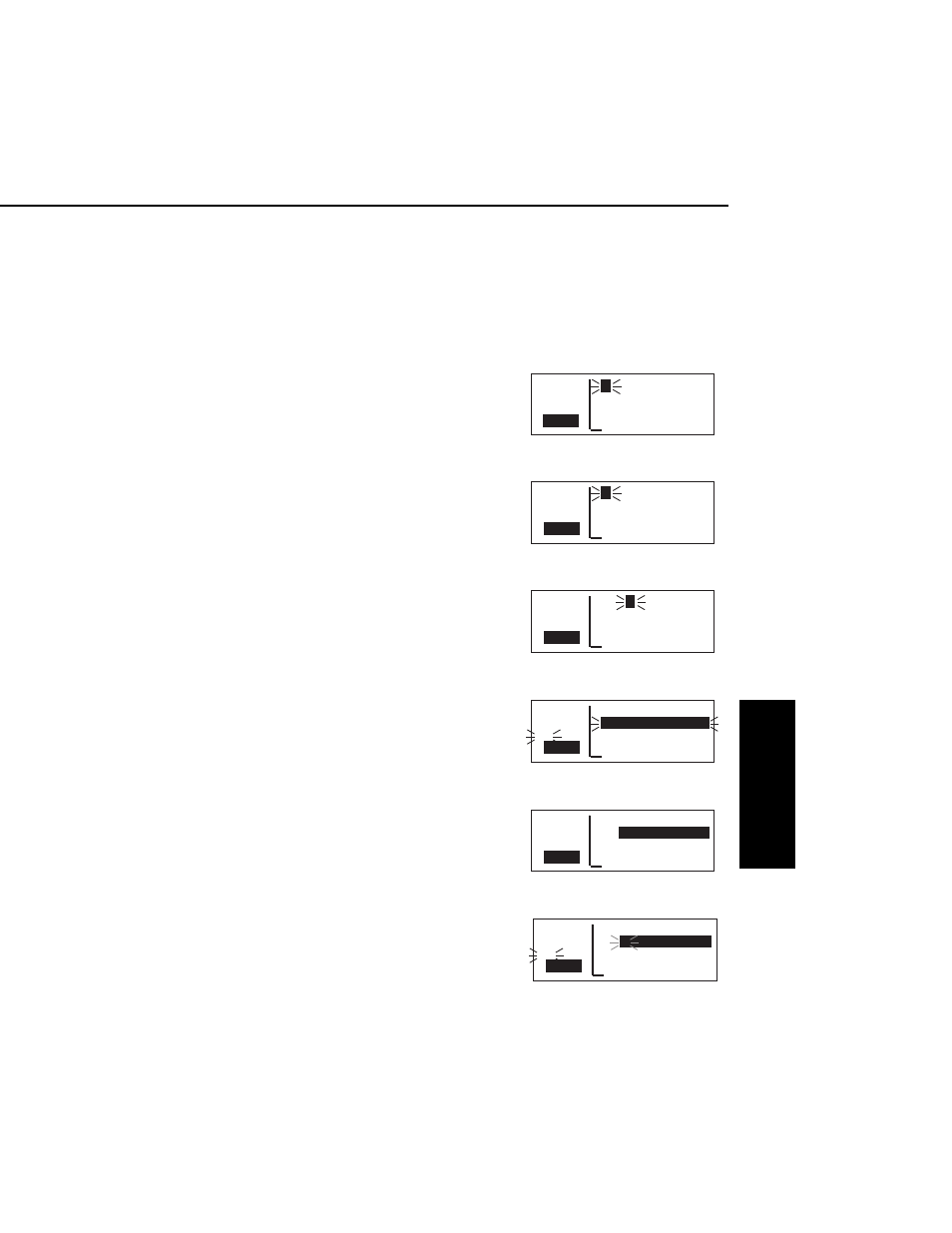
1.
From any supplemental waypoint
(SUP) page, turn on the cursor
(
B
). It will flash over the first
character in the waypoint
identifier field (figure 4-79).
2.
Use the right inner knob to select
the first character of the identifier
(figure 4-80). Remember that
when the cursor is on, the right
inner knob changes the character
and the right outer knob moves
the cursor around.
3.
Spell out the rest of the identifier
using the right inner and outer
knobs (figure 4-81).
4.
Move the cursor down to the
second line, over User Pos L/L?
(figure 4-82).
5.
Press
F
. The display will
change to a format like
figure 4-83.
6.
Use the right inner knob to select
N for north or S for south
(figure 4-84).
KLN 35A Pilot’s Guide
Advanced GPS Operation
4-23
Effective Date 5/95
006-08791-0000 Rev 0
Advanced GPS Operation
Chapter 4
APT VOR NDB SUP ACT NAV FPL CAL SET OTH
åå.ånm FARM USR at:
ееееее
User Pos L/L?
#>Leg User Pos R/D?
CRSR
Present Pos?
Figure 4-82
APT VOR NDB SUP ACT NAV FPL CAL SET OTH
åå.ånm FARM USR
ееееее
_ __°__.__'
>Leg ____°__.__'
CRSR
>---°To ----nm
Figure 4-83
APT VOR NDB SUP ACT NAV FPL CAL SET OTH
åå.ånm FARM USR
ееееее
N __°__.__'
#>Leg ____°__.__'
CRSR
>---°To ----nm
Figure 4-84
APT VOR NDB SUP ACT NAV FPL CAL SET OTH
åå.ånm
L
AKE USR
ееееее N 33°27.42'
>Leg W115°36.81'
CRSR
>201°To 651nm
Figure 4-79
APT VOR NDB SUP ACT NAV FPL CAL SET OTH
åå.ånm
F
USR at:
ееееее User Pos L/L?
>Leg User Pos R/D?
CRSR
Present Pos?
Figure 4-80
APT VOR NDB SUP ACT NAV FPL CAL SET OTH
åå.ånm FAR
M
USR at:
ееееее User Pos L/L?
>Leg User Pos R/D?
CRSR
Present Pos?
Figure 4-81