Adjusting the zoom ranges, View points – Garmin GPSMAP 76CSx User Manual
Page 43
GPSMAP 76CSx Owner’s Manual
7
M
aIn
p
aGeS
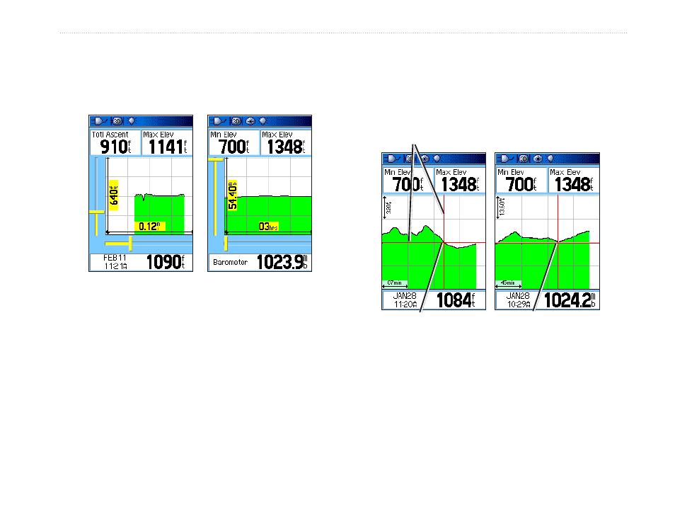
Adjusting the Zoom Ranges
Set the Zoom Ranges for elevation, distance, or time
when you use the View Elevation Plot.
Zoom ranges for
Elevation over
distance plot
Zoom ranges for
Pressure over time
plot
To adjust zoom ranges:
1. Select the type of plot you want to show, and
use the
ROCKER to select Zoom Ranges.
2. Move the
ROCKER up and down to adjust the
vertical distance and left or right to adjust the
time or distance. Press
ENTER to return.
View Points
Scroll through a recorded elevation or pressure profile
to view the elevation or pressure, time of day, and
date the point was created.
Vew pont for an
alttude plot
Red crosshars
Vew pont for a
pressure plot
To use the View Points option:
1. Press
MENU > View Pressure Plot or View
Elevation Plot to open the Plot page.
- GMR 406 (26 pages)
- 340c (2 pages)
- GHP 10 (48 pages)
- GMR 1204 (14 pages)
- GMR24 Hd (12 pages)
- 190-00864-01 (24 pages)
- GFS 10 (24 pages)
- GMR 40 (32 pages)
- GMI 10 (20 pages)
- GMI 10 (8 pages)
- 240 (50 pages)
- Hiking Equipment (2 pages)
- GHS 10i (10 pages)
- G2 (24 pages)
- 100 BLUE (50 pages)
- GSD-20 (12 pages)
- GTX 320 ATC (24 pages)
- 80 (2 pages)
- GMR 41 (32 pages)
- 160 BLUE (50 pages)
- 250C (1 page)
- VHF 200 (10 pages)
- GPSMAP 2008 (124 pages)
- GMR 41 (26 pages)
- 160 (50 pages)
- Gxm 51 (10 pages)
- 160C (32 pages)
- Nuvi 900 (16 pages)
- GSD22 (8 pages)
- 90/140 (32 pages)
- VHF 200 (2 pages)
- Ghc 10 (28 pages)
- GSD 22 (10 pages)
- GPSMAP 3010C (2 pages)
- GPSMAP 3010C (130 pages)
- GPSMAP 76CSx (2 pages)
- GPSMAP 76S (18 pages)
- GPSMAP 76S (76 pages)
- GPSMAP 172C (110 pages)
- GPSMAP 3005C (124 pages)
- GPSMAP 3005C (2 pages)
- GPSMAP 276C (2 pages)
- GTX 328 (10 pages)
- GPSMAP 526s (84 pages)