Nav tide, Tide differential – Furuno CI-80 User Manual
Page 7
3
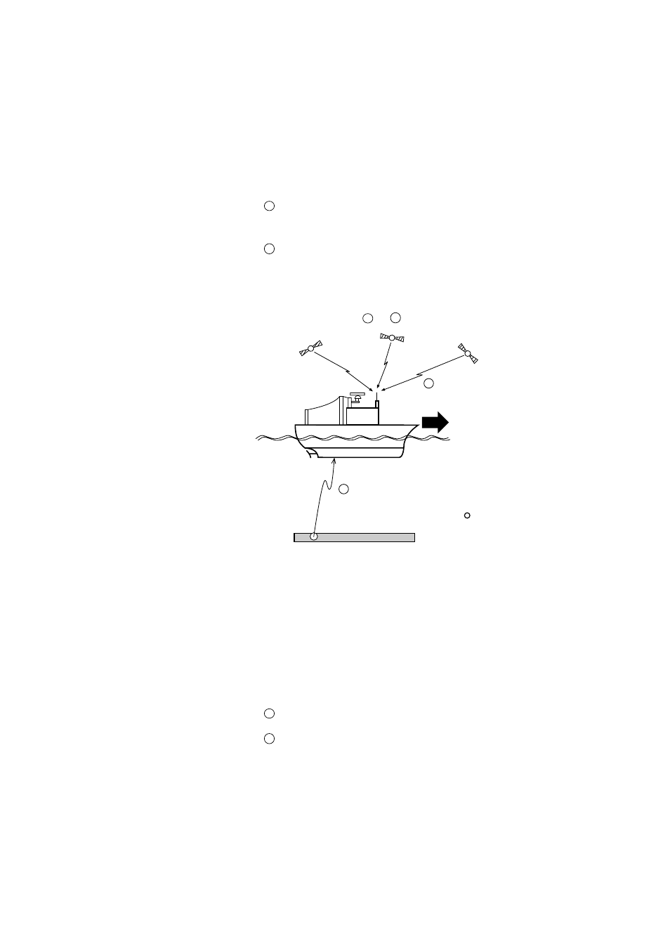
Nav Tide
Nav-Tide is an absolute movement of watermass at a particular
depth, taking speed information from the external navigator
(GPS) as a pseudo ground tracking speed.
To calculate Nav-tide, the following two data are required:
1
Ship’s speed and course obtained by external navigation
equipment (GPS)
2
Ship’s speed and course based on measuring layer (A)
Nav-tide is, then, given as a difference of these two speed
vectors.
Absolute Tide =
1
–
2
GPS satellites
Nav-aided speed
(Pseudo ground tracking speed)
Water tracking
speed
Layer (A)
:Base of measurement
1
2
Figure 4
Tide Differential
Tide differential is a relative movement of tides at different
depths, layer (A) and layer (B).
To calculate tide differential, the following two data are used:
1
Ship’s speed and course based on layer (A)
2
Ship’s speed and course based on layer (B)
Tide differential between two layers is, then, given as a
difference of these two speed vectors.
- FAR-2805 Series (169 pages)
- FR-8062 (2 pages)
- FR-8122 (56 pages)
- CH-37 (71 pages)
- CH-37 (90 pages)
- FAR-2XX7 (4 pages)
- FAR-2XX7 (2 pages)
- FELCOM16 (4 pages)
- FRS-1000B (8 pages)
- FRS1000 (8 pages)
- Ls4100 (48 pages)
- 520 (73 pages)
- Marine Radar (24 pages)
- 1944C-BB (233 pages)
- 1733C (260 pages)
- FR-2105 (197 pages)
- FMD-8010 (50 pages)
- GD-1900C (260 pages)
- Black Box Video Sounder FCV-1200BB (2 pages)
- FR-1505 MARK-3 (4 pages)
- 1762 (252 pages)
- NAVnet DRS12A (44 pages)
- FAR-2137S (8 pages)
- FAR-2127 (136 pages)
- FA30 (6 pages)
- Satellite Compass SC-50/110 (30 pages)
- 1715 (2 pages)
- 1715 (48 pages)
- 1734C (55 pages)
- GD-1720C (53 pages)
- Mu 120c (2 pages)
- NAVNET GD-1920C (239 pages)
- FAR-28x7 Series (299 pages)
- FAR-2837S (8 pages)
- BBWX1 (2 pages)
- 851 MARK-2 (37 pages)
- 851 MARK-2 (47 pages)
- BBFF3 (1 page)
- CSH-53 (106 pages)
- CSH-53 (108 pages)
- FCV295 (53 pages)
- FR1500 Mk3 (79 pages)
- FI-50 Series (2 pages)
- FCV-1150 (32 pages)