AvMap ULTRA UX0EFS3XAM User Manual
Page 17
16
- User and Installation Manual
AvMap
Ultra EFIS
User and Installation Manual -
17
AvMap
Ultra EFIS
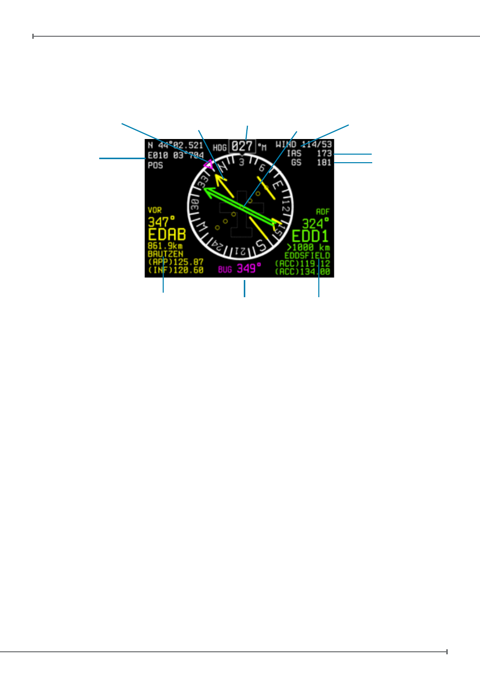
4.3 HSI display mode
The HSI shows navigation data: position, distance, directions, and radials relative to
reference navigation points. Figure 10
shows the data layout on the screen:
Figure 10
Current Position
VOR
indicator
Heading
ADF
Indicator
Wind
(Estimated)
IAS
Ground Speed
ADF Info box
VOR Info box
Heading Bug
Heading Bug
Heading is shown in degrees with respect to magnetic north or true north. The Ultra
contains an internal world magnetic model that allows it to calculate the local magnetic
deviation and dip. A vertical card compass is also displayed for fast heading reference.
Note: in the “SETUP” menu you can choose reference with respect to magnetic north
or true north.
Course over Ground (COG) is shown on the compass instead of heading in case the
magnetometer is not calibrated or when the magnetometer has an failure. The COG
data is based on GPS source.
Note: If the compass source is GPS, the device shows “COG” aside the compass. If
the compass source is the magnetometer, the device shows “HDG” aside the compass.
Both can be shown in reference to magnetic north or true north.
Current Position is shown in latitude/longitude format. The Ultra can calculate position
even in the absence of GPS. In absence of GPS fix the position indicator change in
RED.
Wind data is approximated and displayed by the system when suitable GPS, compass
and IAS data are available. Wind direction is referred to the direction where the wind is
coming from.
Note: The speed units selected in the “SETUP” menu are also applied to wind speed.
Note: Without compass calibration (see chapter 3) wind data are not available.