4 poi settings – AvMap GeoPilot II User Manual
Page 35
35
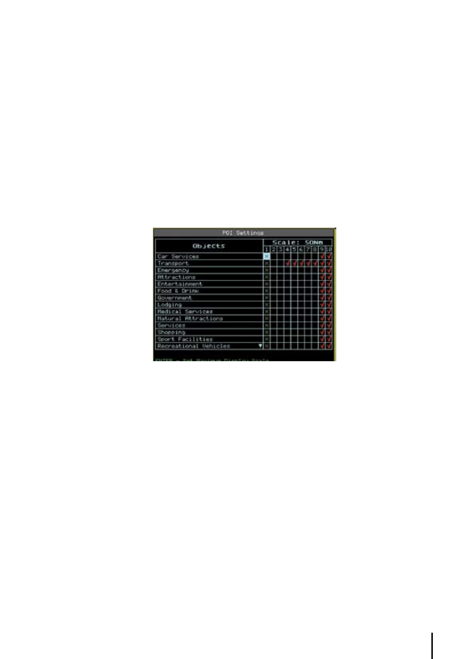
Scroll through the cells using the cursor key. To select the desired scale you would like the map to
begin displaying data for the category, place the cursor within the cell and press ‘ENT’. (The map
scale for the cell is displayed at the top right.) Any box with an “X” indicates the feature is not
available at that chart scale.
All data for that category will begin to display at that chart scale checked and all scales below. It
is also possible tochoose the catrografic information to be shown based on the selected “Cycle”
program.
There are 3 programs available thatthe user can personalize through the 1/2/3 Cycle columns. For
each of them it is possible to activate/deactivate any cartographic object. To change the program
from the map pages it is necessary to press ‘CYCLE’.
3.6.4 PoI Settings
This feature is similar to the Selective Display, but refers to the Points of Interest (POI).
‘MENU’ + “ POI SETTINGS...” + ‘ENT’
Fig. 3.5.13- POI Settings