Understanding convective sigmets – BendixKing KAC 503 - Supplemental System FIS User Manual
Page 16
12
Rev 1 Oct. 2003
UNDERSTANDING CONVECTIVE SIGMETS
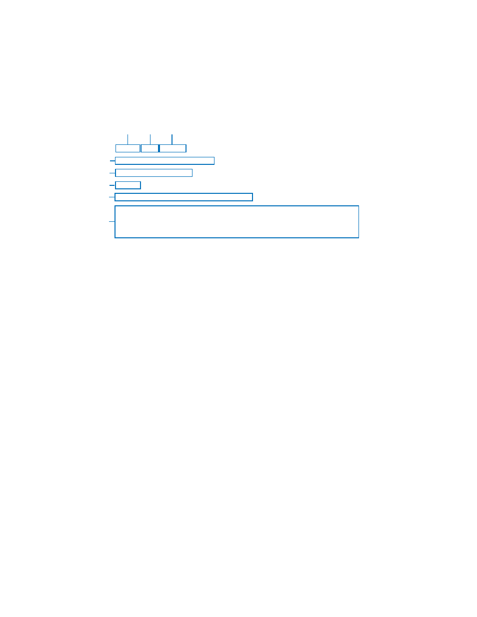
The following is an example of a typical Convective SIGMET with an expla-
nation of the elements.
1.
Station Identifier: MKCC
MKC is the station identifier of the Aviation Weather Center (AWC) in
Kansas City.
The C denotes the report is for the Central portion of the continental
United States. The choices are as follows:
C
Central
E
East
W West
Convective SIGMETs are issued for:
Severe weather including: (a)Surface winds
≥
50 knots,
(b) Surface hail
≥
3/4 inch in diameter or (c) Tornadoes
Embedded thunderstorms (obscured by haze or other phenomena)
Line of thunderstorms
Thunderstorms
≥
VIP level 4 affecting
≥
40% of an area
≥
3000 sq. mi.
2.
Report Type: WST
WST indicates this is a convective SIGMET.
3.
Date and Time Issued: 221855.
22 indicates the 22nd day of the month. 1855 indicates UTC.
4.
This line is the identifying number of the Convective SIGMET.
Numbering begins daily at 0000 UTC. The C denotes the Central por-
tion of the country.
5.
This line indicates that CONVECTIVE SIGMET 20C is VALID UNTIL
2055Z time. Expiration time is two hours after issuance, but Convective
MKCC WST 221855
CONVECTIVE SIGMET 20C
VALID UNTIL 2055Z
ND SD
FROM 60W MOT-GFK-ABR-90W MOT
INTSFYG AREA SVR TSTMS MOVG FROM 2445. TOPS ABV FL450.
WIND GUSTS TO 60KT RPRTD. TORNADOES…HAIL TO 2 IN…WIND
GUSTS TO 65KT PSBL ND PTN.
1
3
4
2
5
6
7
8