How to use the map, Basic operation, How to view the map of the current location – Pioneer AVIC700D User Manual
Page 34: Caution, Map mode, Driver’s view
33
Chapter
1
Basic Operation
How to Use the Map
Most of the information provided by your Navigation System can be seen on the map. You need
to get to know how the information appears on the map.
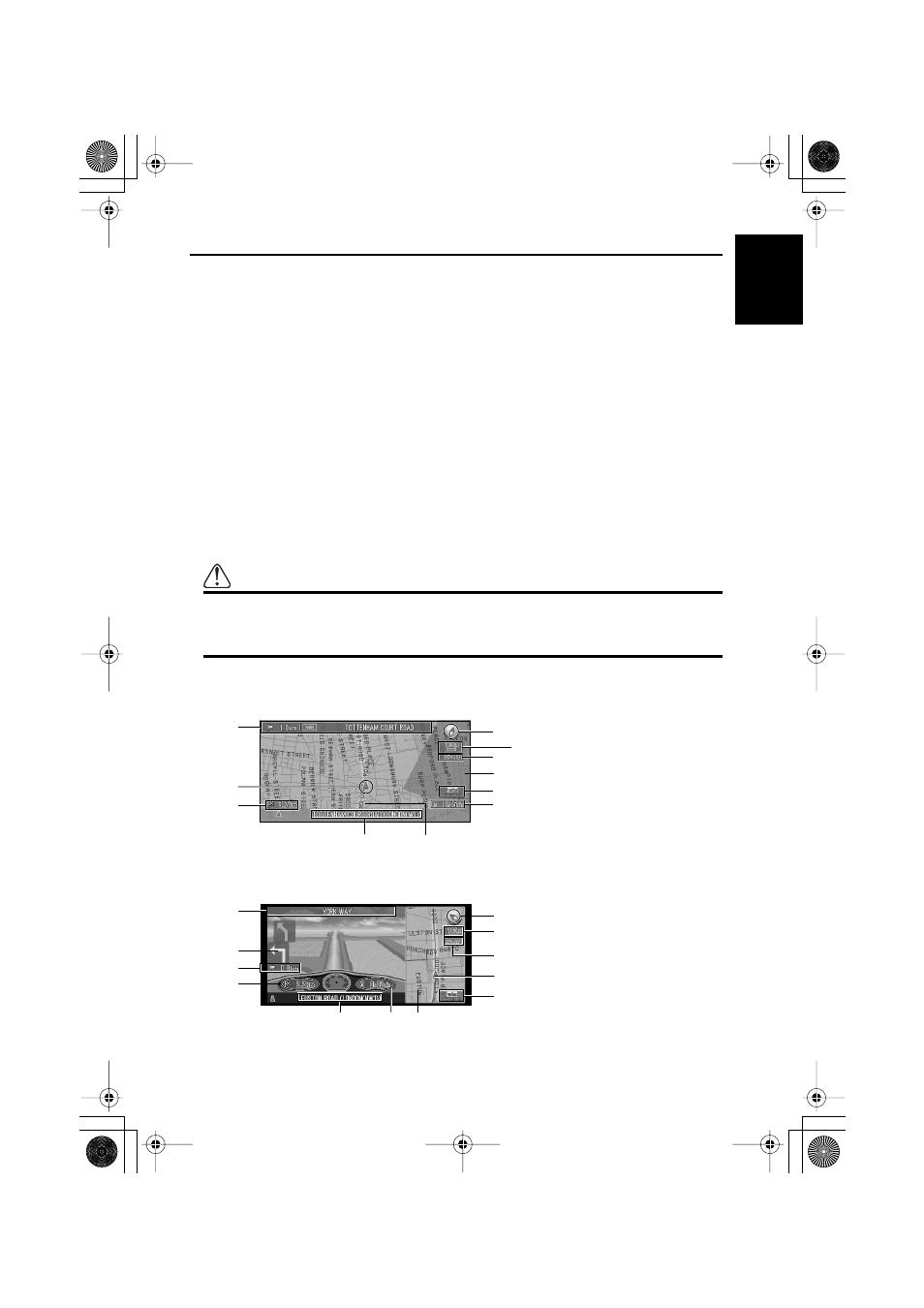
■How to view the map of the current location
The display is like a conventional map, and shows roads of various designations as well as
geographical features such as rivers, parks, and forests.
While the menu is displayed, you can switch to the map of your surroundings, by pressing the
NAVI button.
There are four types of map display. You can switch the indication method of the map by
clicking the OK button.
• Map Mode
• Driver’s View
• Arrow Mode (during route guidance only)
• Mixed Mode (during route guidance only)
➲
When “Close-up of Junction” (see “Close-up of Junction” on page 93) is set “ON”, an
enlarged map showing the area around a junction appears as you approach the junction.
Caution
In Driver’s view, the speedometer is indicated on the screen, but this will differ
from the actual speed of your vehicle. Use the speedometer of your vehicle for
confirming the speed.
Map Mode
The map of your surroundings is shown.
Driver’s View
The map from the driver’s viewpoint is shown.
(3)
(4)
(5)
(1) (2)
(10)
(9)
(8)
(7)
(6)
(11)
(15)
(4)
(5)
(10) (12)
(1)
(9)
(3)
(8)
(7)
(6)
(2)
(14)
CRB1875A_Eng.book Page 33 Thursday, March 27, 2003 1:22 PM