Map setup – Garmin GPS 125 Sounder User Manual
Page 60
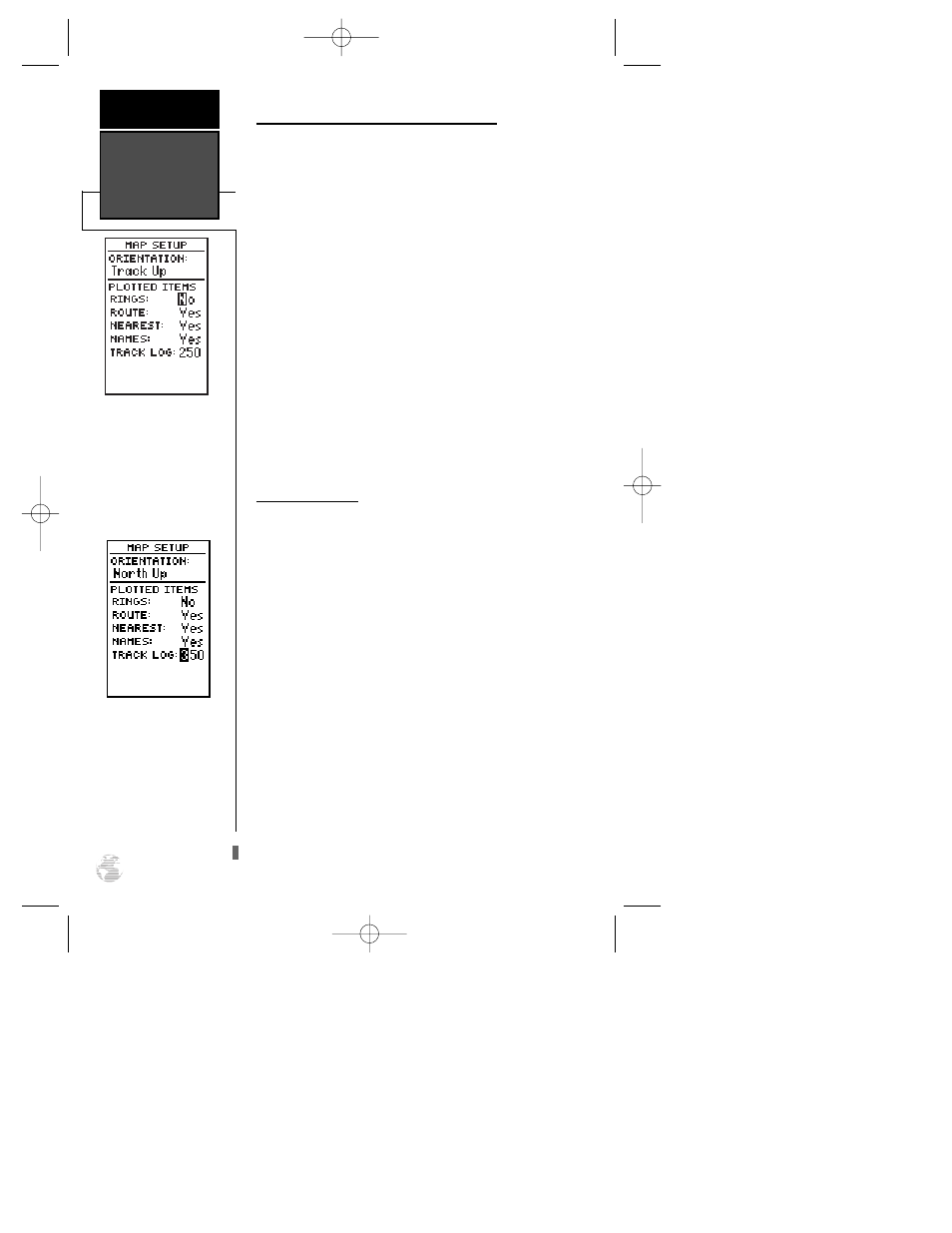
Selecting Displayed Items on the Map Page
The rest of the map setup page lets you specify what
items are displayed or plotted on the Map Page. The
first four plot items may be turned on or off by selecting
‘Yes’ or ‘No’ in the appropriate field:
• The ‘RINGS’ selection will display the three pre-
sent position range rings on the map.
• The ‘ROUTE’ selection will plot the straight leg
lines between waypoints of an active route and
display all route waypoint names.
• The ‘NEAREST’ selection will show the nine near-
est waypoints to your present position (not the
target crosshair on the map).
• The ‘NAMES’ selection will display the waypoint
name for the nine nearest waypoints.
To turn a plotted item on or off:
1. Highlight the confirmation (Yes or No) field for the plot-
ted item and press
F
. Make your desired selection
and press
F
.
Track Log Display
The track log option sets the number of points the
unit will attempt to display on the Map Page. The
default setting of 250 points provides good resolution
with minimal screen clutter. The maximum setting is
768 points. Once you’ve reached the maximum number
of track points, the older points will be lost as new
points are added. Adjusting the track points displayed
will not affect whether or not the receiver records a
track log or the ability to create a TracBack route.
To enter a log setting:
1. Highlight to the ‘TRACK LOG’ field and press
F
.
2. Enter a value in the 3-digit field and press
F
. If you
do not want to display a track, enter ‘000’.
Map Setup
REFERENCE
56
A higher track log value will
make a more detailed track
log but will take up more
memory.
On-screen range rings will
appear on the map when
the ‘RINGS’ option is set to
the ‘Yes’ position.
125 Man Rev B 7/23/98 11:48 AM Page 56