Garmin StreetPilot 2650 User Manual
Streetpilot
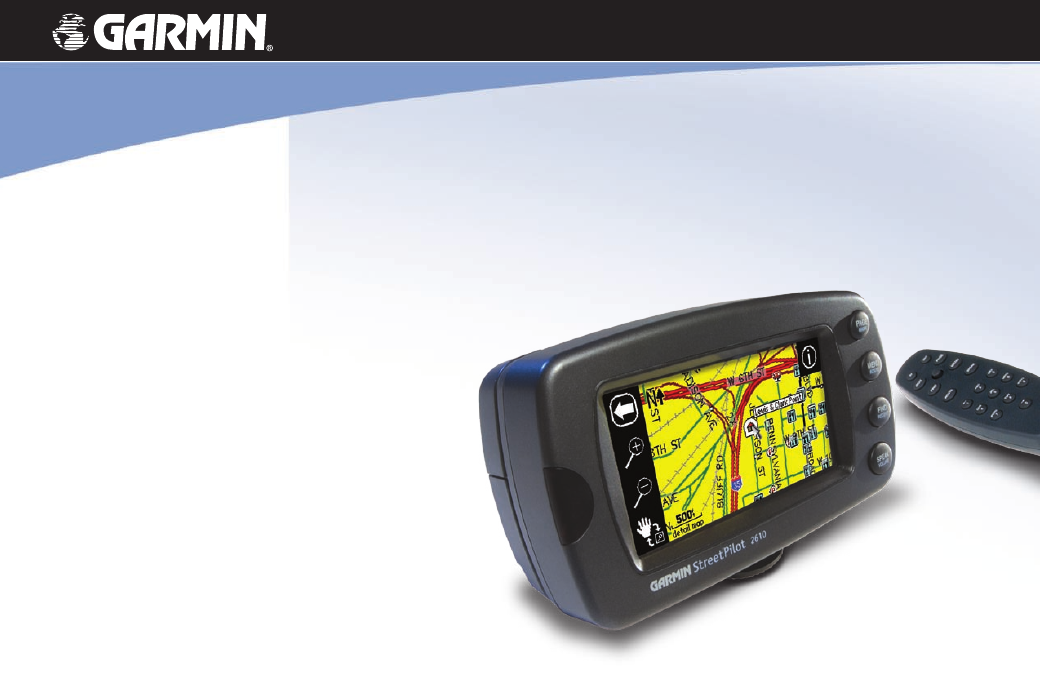
Table of contents
Document Outline
- Preface
- Customer Service Product Registration
- Packing List
- Table of Contents
- Getting Started
- WHERE DO I BEGIN?
- A Tutorial: Finding and Routing to a Restaurant
- Manual Conventions
- Introducing the StreetPilot 2610/2650
- Front and Rear View of the StreetPilot
- Caring for your StreetPilot
- Turning the StreetPilot On and Off
- Using the Keypad
- Using the Touchscreen
- Calibrating the Touchscreen
- Using the Remote Control
- Adjusting the Speaker Volume
- Learning how to use the Map Page
- Viewing the Map Page for the First Time
- Using the Map Page Features
- Viewing the Map Page While Driving
- Driving with Dead Reckoning (2650 Only)
- Finding Places
- Finding a City
- Finding an Address or Intersection
- Finding an Exit
- Finding a Waypoint
- Advanced Find Features
- Planning a Trip
- Finding “Recently-Found” Places
- Creating your own Routes
- Creating your First Route
- Setting a HOME Waypoint
- Saving a Route
- Deleting or Renaming a Saved Route
- Modifying a Route
- Measuring Distances Between Two Places
- Customizing your StreetPilot 2610/2650
- Adjusting the Backlight and Contrast
- Turning off Satellite Reception for Indoor Use
- Customizing your Map Page
- Hiding/Showing Data Tabs on your Map Page
- Customizing the Overall Setup of Your StreetPilot
- Obtaining the latest Software Upgrades
- Understanding the GPS Information Page
- What is GPS?
- The GPS Information Page
- Appendix A: Vehicle Installation
- Appendix B: DR Cable Wiring (2650 Only)
- Appendix C: Using Diacritical Marks
- Appendix D: CompactFlash® Data Cards
- Appendix E: Adding Maps to your StreetPilot
- Appendix F: Messages
- Appendix G: Specifications
- Appendix H: Safety and Regulatory Information
- Limited Warranty