Legend, Map detail, Map orientation – Garmin MX20 User Manual
Page 77: Legend map detail map orientation, Detailed operation
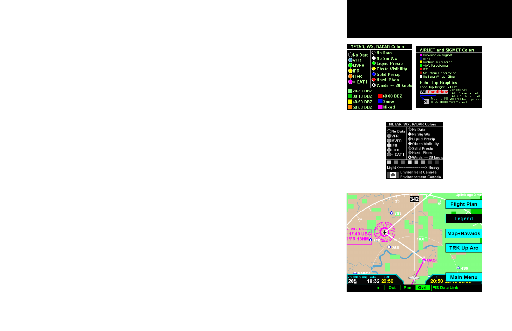
Detailed Operation
Legend
Press MENU/ENtER key and then press the LEGEND Menu Item key to display the legends describing the
graphic display colors. Press the LEGEND Menu Item key once to display a legend for the Metar, Weather, and
Radar colors. Press the LEGEND key a second time to display a legend for AIRMET and SIGMET colors and
EchoTop graphics.
When viewing the Canadian radar data, the following legends will appear. Only the lower portion of the
legend changes for Canadian radar data.
Map Detail
Press MENU/ENtER key and then press the Map Detail Menu Item key to choose between the display of No
Overlays, the Base Map, or Map and Nav Aids.
Map Orientation
Press MENU/ENtER key and then press the Map Orientation Menu Item key to choose the configuration of
the map orientation of DTK Up, North Up, TRK Up, TRK Up Arc, or TRK Up 360.
WSI - FIS
WSI FIS Graphic Weather Legend (US)
WSI FIS Graphic Weather Legend (Canada)
WSI FIS Graphic Weather Menu Items (Trk Arc Up)