Info displays – Simrad HS50 User Manual
Page 45
OPERATING INSTRUCTIONS
20221081 / F
37
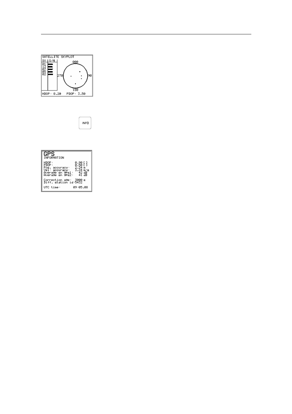
Third NAV2/POS display: the Satellite skyplot.
This display shows satellites in sight by the Sensor unit, and
which satellites the HS50 is tracking. The satellites are presented
according to satellite geometry. The bars on the left side of this
display indicate the signal-to-noise level for each satellite.
Info displays
When pressing the
INFO
button, the system will page through a
number of displays for information about system configuration
and performance. The information on some of these displays is
mainly used for troubleshooting the system.
In the GPS information display details for the position solution
is presented. This information is mainly for trouble shooting of
the system.
An explanation of the information shown is as follows:
HDOP
PDOP
Quality indicators for the GPS solution.
Pos. accuracy
Estimated accuracy on the position solution (RMS).
Vel. Accuracy
Estimated RMS accuracy on the velocity solution (RMS).
Average sn gps1
Average sn gps2
Average signal-to-noise ratio on the GPS receiver 1 and 2.
Correction age
Age of differential corrections. If HS50 receives no differential
correction, the displayed correction age will be high. See No
Differential corrections, page 47 for trouble shooting loss of
differential signal.
Diff. Station id
Actual reference station utilized in the position solution.
UTC time
World time referred to UTC.