Garmin G2 User Manual
Page 12
BlueChart g2 User’s Guide
v
IewIng
b
lue
c
hart
g
2 >
u
nderstandIng
b
lue
c
hart
g
2 d
ata
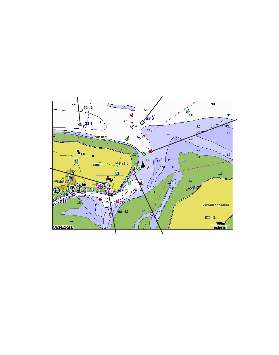
Other features common to most BlueChart g2 data include:
• Depth contour lines (with deep water represented in white)
• Inter-tidal zones
• Spot soundings, as depicted on the original paper chart
• Navigational aids and symbols
• Obstructions and cable areas
Tide
Station
Yacht
Harbor
Wreck
Marina
Services
Buoy
Information
Garmin includes charts and symbols shown on NOAA chart 1, and marine services from other
sources. For more information about nautical chart symbols in the USA, see Chart No. 1
Nautical Chart Symbols Abbreviations and Terms at
See also other documents in the category Garmin Sports and recreation:
- GMR 406 (26 pages)
- 340c (2 pages)
- GHP 10 (48 pages)
- GMR 1204 (14 pages)
- GMR24 Hd (12 pages)
- 190-00864-01 (24 pages)
- GFS 10 (24 pages)
- GMR 40 (32 pages)
- GMI 10 (20 pages)
- GMI 10 (8 pages)
- 240 (50 pages)
- Hiking Equipment (2 pages)
- GHS 10i (10 pages)
- 100 BLUE (50 pages)
- GSD-20 (12 pages)
- GTX 320 ATC (24 pages)
- 80 (2 pages)
- GMR 41 (32 pages)
- 160 BLUE (50 pages)
- 250C (1 page)
- VHF 200 (10 pages)
- GPSMAP 2008 (124 pages)
- GMR 41 (26 pages)
- 160 (50 pages)
- Gxm 51 (10 pages)
- 160C (32 pages)
- Nuvi 900 (16 pages)
- GSD22 (8 pages)
- 90/140 (32 pages)
- VHF 200 (2 pages)
- Ghc 10 (28 pages)
- GSD 22 (10 pages)
- GPSMAP 3010C (2 pages)
- GPSMAP 3010C (130 pages)
- GPSMAP 76CSx (64 pages)
- GPSMAP 76CSx (2 pages)
- GPSMAP 76S (18 pages)
- GPSMAP 76S (76 pages)
- GPSMAP 172C (110 pages)
- GPSMAP 3005C (124 pages)
- GPSMAP 3005C (2 pages)
- GPSMAP 276C (2 pages)
- GTX 328 (10 pages)
- GPSMAP 526s (84 pages)