Veris Technologies 3150 Soil EC Mapping System - Trouble-shooting User Manual
Page 14
Procedure #5: Diagnosing GPS-related problems
If you do not see a GPS, DGPS, or RTK in the upper left-hand corner of the EC Surveyor
screen, you do not have GPS coming in, and no data will be sent out the serial port for
logging.
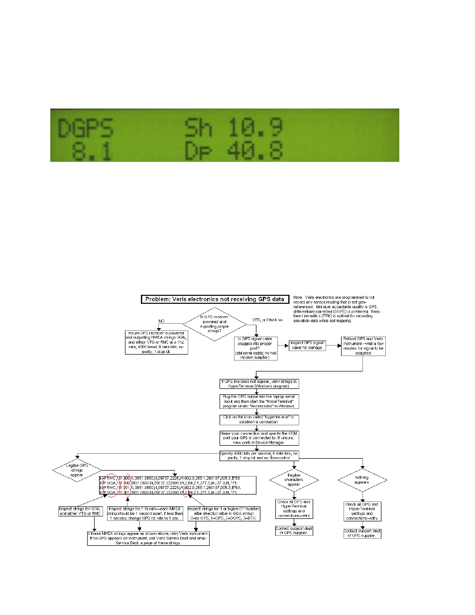
Figure 5.1
Insure your GPS receiver is powered and outputting NMEA strings GGA, and either VTG
or RMC at a 1hz rate; 4800 baud, 8 data bits, no parity, 1 stop bit. Verify that your GPS
cable is sending GPS data through pin 2, pin 5 is ground, and no other pins have signal or
power on them. The most common issue is hz rate. If the GPS has been used for
lightbar guidance it may have been set to a 5 or 10 hz rate. It will need to be changed to 1
hz in order for the EC Surveyor to accept it.
Shown below is a Troubleshooting tree for diagnosing GPS signal problems. It is not
meant to replace your GPS receiver user manual
—it merely shows how to determine if
your receiver is sending the GPS signal that the EC Surveyor needs.
Figure 5.2