NDrive NLife User Manual
Page 4

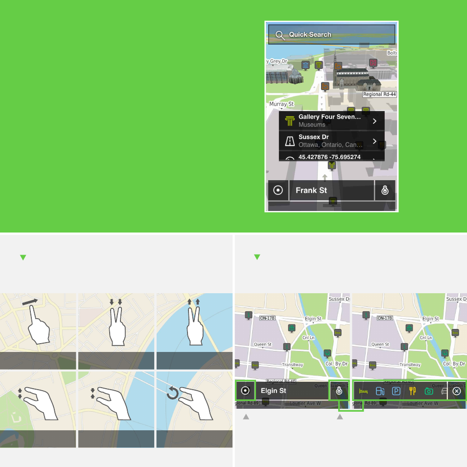
We combined an aesthetically appealing map interface with
functionality and the result is a more intuitive use and interac-
tion with the map.
Different areas are represented with a specific colour and at a
quick glance you will be able to distinguish between a garden
and an airport. The 3D buildings allow you to recognize your
surroundings, so that you always know where you are.
The information on the map is more accessible - just click
anywhere to have access to the details of that location - and
using the map buttons, you can make visible exactly what you
want.
On settings, you can also customize the map, choosing for
instance if you want 3D buildings to be visible or not.
Map
Drag
Drag down 2D to 3D
Drag up 3D to 2D
Pinch to zoom in
Pinch to zoom out
Rotate
Map gestures
You can use all these gestures to interact with the map.
Tap here to select the POI categories
you wish to be visible on the map.
If you’ve dragged the map,
tap here to return to your
location.
Map buttons
Use these shortcuts to see exactly what you want on the
map.
