Acura 2011 RL - Advanced Technology Guide User Manual
Page 13
22
20
21
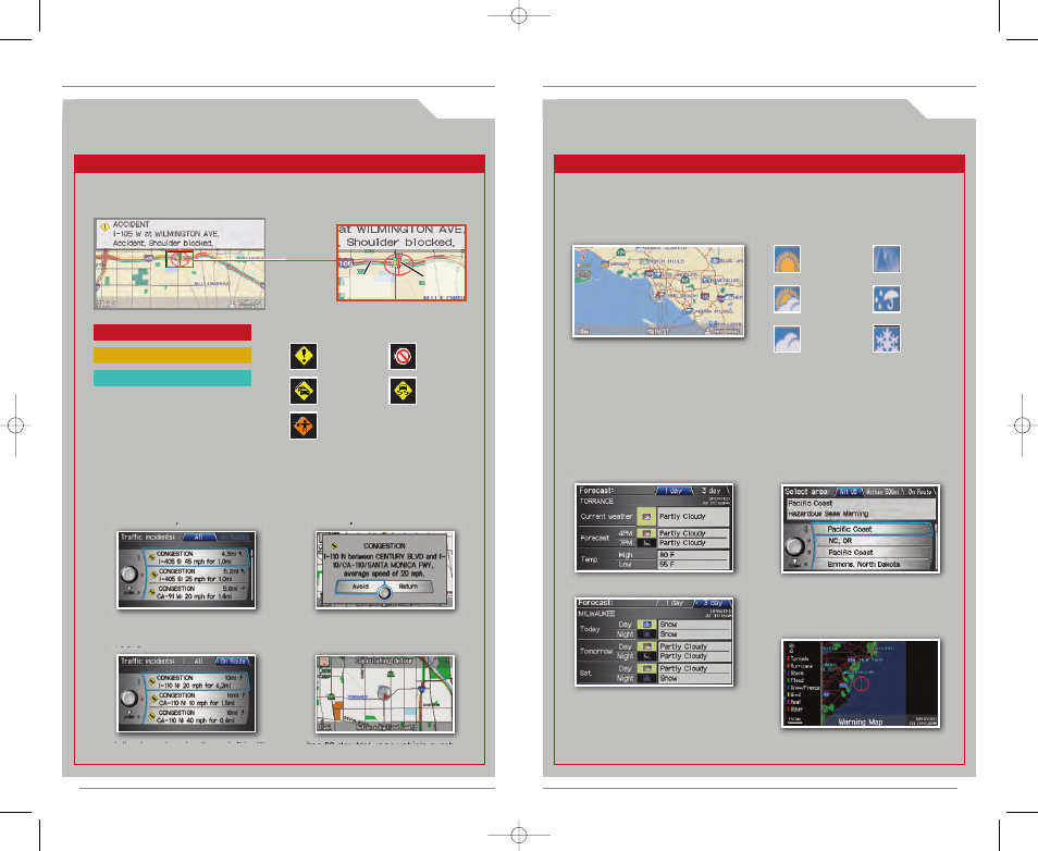
A C U R A L I N K R E A L - T I M E T R A F F I C
T M
*
( i f e q u i p p e d )
Provides continuously updated info, including traffic speed, incidents, and
construction in major metro areas.
A C U R A L I N K R E A L - T I M E W E A T H E R
T M
*
( i f e q u i p p e d )
Press and release the Navi Talk button before you give a command.
D i s p l a y i n g W e a t h e r I c o n s
Say “Display weather”**
to view weather icons for each city.
* Subscription-based service through Sirius XM Radio
®
(free 90-day trial upon vehicle purchase)
** You can also display this information manually using the Interface Dial from the Map menu.
Clear
Weather Icons
Partly
Cloudy
Cloudy
Fog
Rain
Snow
Provides continuously updated weather conditions, warnings, and forecasts in
major metro areas.
W e a t h e r F o r e c a s t
Say “Weather forecast” to view a
1-day or 3-day forecast of your
current position or city vicinity.
W e a t h e r W a r n i n g M a p
Say “Warning map” to view color-
coded severe weather systems.
D i s p l a y i n g W e a t h e r I n f o r m a t i o n
Say “Information,” then “Weather information” for the following options:
Press and release the Navi Talk button before you give a command.
Displaying Traffic Information
Say “Display traffic”** to view highway flow data.
NOTE: Traffic flow and incident
icons are displayed on map
scales of 5 miles (8 km) or less.
Heavy traffic
Moderate traffic
Free-flow traffic
* Subscription-based service through Sirius XM Radio
®
(free 90-day trial upon vehicle purchase)
** You can also display this information manually using the Interface Dial from the Map menu.
Incident
Incident Icons
Congestion
Construction
Road
closed
Weather
1. Say “Display traffic
incidents” to view a list of
incidents in your area.
2. Say “On route” to view
specific incidents on your
route.
3. Say the number of the
incident you wish to avoid,
and say “Avoid.”
4. The system calculates a
new route.
T r a f f i c R e r o u t i n g
T M
The system can automatically provide detours around traffic incidents (if
Traffic Rerouting is ON in Setup), or you can calculate a new route manually.
Traffic Flow
data
Incident
icon
NOTE: Weather icons are
available on all map scales.
23
W e a t h e r W a r n i n g L i s t
Say “Warning list sorted by distance”
to view a list of all U.S. weather
warnings by distance.
11 RL ATG:ATG_NEW STYLE
8/25/2010
3:14 PM
Page 13