Dxf400800, Dxf3dpc, Dxf3dp+c – Leica Geosystems TPS800 DXF Export User Manual
Page 4: Dxf2dpc, 885m, Pointid, Code, Height, Eastings northings, Layer
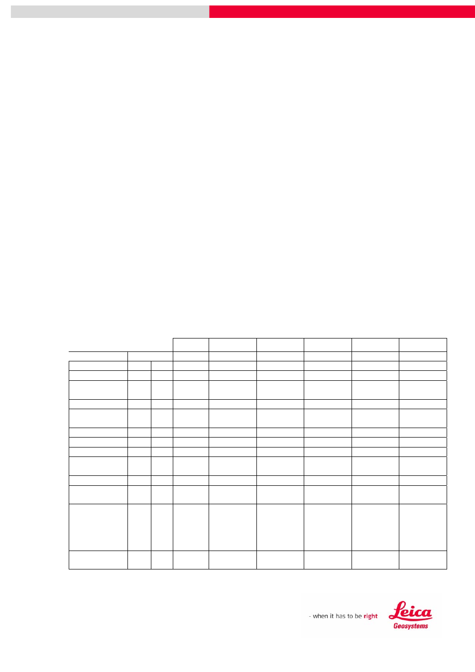
TPS400 and TPS800 DXF Data Output Page
4
e.g.
+
27,PLP,1106.525,1098.584,102.885
is the text written against a point with:
Point Number
27
Code
PLP
Eastings
1106.525m
Northings
1098.584m
Height
102.885m
dxf400800
This option creates a 3D DXF file of the measured points, which are placed in a layer
called Point, using a cross symbol. The Point Numbers are placed in the layer Pt_id,
the Codes in the layer Code, the Height in the layer Height and the Eastings, and
Northings and are placed in the layer Co_ords. A space is placed in front of the
Eastings and between the Eastings and Northings.
+
PointId
+
Code
+
Height
+
Eastings Northings
Layer
Point
Height
Pt_no
Code
Co-ords
Pt_id
3D / 2D
dxf3DP
3D
+
dxf3DPC
3D
+
Point
Id
Code
dxf3DP+C
3D
+
Point
Id
Code
dxf2DPC
2D +
Point
Id
Code
dxf2DP+C
2D +
Point
Id
Code
dxf3DC+H
3D
+
Height
dxf2DC+H
2D +
Height
dxf3DH
3D
.
Height
dxf3DPH
3D
. Point
Id
Height
dxf2DH
2D
.
Height
dxf2DPH
2D .
Point
Id
Height
dxfPCENH
3D
+
Point
Id
Code
Eastings
Northings
Height
dxf40080
3D
+
Height Code
Eastings
Northings
Point Id