2 terrain compensation, Terrain compensation – Leica Geosystems Leica mojoXact Plus User Manual
Page 40
40
Vehicles and Implements, Leica mojoXact Plus
4.2
Terrain Compensation
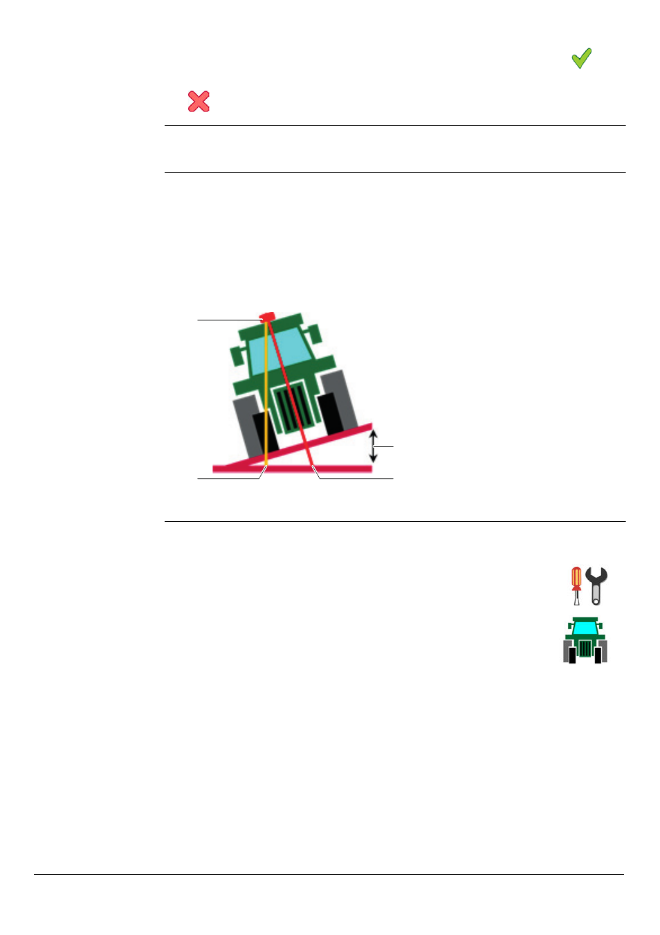
Explanation
For accurate positioning and guidance, it is important to perform terrain compensa-
tion as this feature allows the mojoXact Plus to calculate the position of the GPS
antenna as the vehicle navigates unlevel terrain. This is demonstrated by the picture
below which illustrates a vehicle tilting as it would on hilly terrain. Without terrain
compensation, the position of the vehicle is shown by the uncorrected position. With
terrain compensation, the position of the vehicle is the corrected position. The differ-
ence in these two positions is obvious, clearly demonstrating why the use of terrain
compensation is necessary for accurate positioning and guidance.
Terrain compensa-
tion setup, step-
by-step
To perform terrain compensation, carry out the following steps:
8. To accept the values and return to the main navigation screen, select
.
To cancel any changes to the values and return to the Vehicle Type screen, select
.
a) GPS antenna
b) Uncorrected position
c)
Roll angle
d) Corrected position
a
b
c
d
1. On the main navigation screen, select the Settings button.
The Settings menu appears.
2. On the Settings menu, select the Vehicle Settings button.
The Vehicle Settings menu appears.